En
Log in
All resources
Create a design
Tools
38,646 Free Artworks of Map
maps of africa
africa in the 1890s
maps from the earth and its inhabitants, vol. xii
maps from the earth and its inhabitants, vol. xiii
maps from the earth and its inhabitants, vol. xi
bibliothèque nationale de france
john rocque 1746 london map (a1-h3)
john rocque
maps by willem and johannes blaeu
africa in the 1880s
maps of barth by braun & hogenberg
duchy of pomerania
old maps of rennes
adolphe périaux
maps by willem and johannes blaeu
old maps of capitanata
maps by petrus schenk
adorf/vogtl.
maps of portugal by fernando álvares seco
john rocque 1746 london map (a1-h3)
john rocque
augustine ryther
oxford castle
john rocque 1746 london map (a1-h3)
john rocque
john rocque 1746 london map (a1-h3)
john rocque
john rocque 1746 london map (a1-h3)
john rocque
john rocque 1746 london map (a1-h3)
john rocque
john rocque 1746 london map (a1-h3)
john rocque
maps from the earth and its inhabitants, vol. xii
africa in the 1890s
maps from the earth and its inhabitants, vol. xiii
maps of africa
maps from the earth and its inhabitants, vol. xiii
maps of africa
maps from the earth and its inhabitants, vol. xii
africa in the 1890s
maps by willem and johannes blaeu
old maps of groningen (city)
maps from the earth and its inhabitants, vol. xiii
maps of africa
maps from the earth and its inhabitants, vol. xii
africa in the 1890s
maps from the earth and its inhabitants, vol. xiii
maps of africa
maps from the earth and its inhabitants, vol. xi
africa in the 1880s
maps from the earth and its inhabitants, vol. xi
africa in the 1890s
maps from the earth and its inhabitants, vol. xiii
maps of africa
maps from the earth and its inhabitants, vol. xii
africa in the 1890s
maps from the earth and its inhabitants, vol. xiii
africa in the 1890s
maps from the earth and its inhabitants, vol. xiii
maps of africa
maps from the earth and its inhabitants, vol. xi
africa in the 1890s
maps from the earth and its inhabitants, vol. xiii
africa in the 1890s
maps from the earth and its inhabitants, vol. xi
africa in the 1880s
maps by giacomo gastaldi
cornelis de jode
maps from the earth and its inhabitants, vol. xiii
africa in the 1890s
maps from the earth and its inhabitants, vol. xiii
africa in the 1890s
maps from the earth and its inhabitants, vol. xii
africa in the 1890s
maps from the earth and its inhabitants, vol. xii
africa in the 1890s
maps from the earth and its inhabitants, vol. xi
africa in the 1890s
africa in the 1890s
maps of africa
maps from the earth and its inhabitants, vol. xi
africa in the 1890s
maps from the earth and its inhabitants, vol. xi
africa in the 1890s
maps from the earth and its inhabitants, vol. xii
africa in the 1890s
maps of mexico by mercator-hondius
perris maps of manhattan published 1852–1853
centre market place (manhattan)
map of amsterdam, 1544
stadsarchief amsterdam
1750s maps of the caribbean
maps by thomas kitchin
maps of spain by tomas lopez
1778 maps of spain
maps of spain by tomas lopez
1778 maps of spain
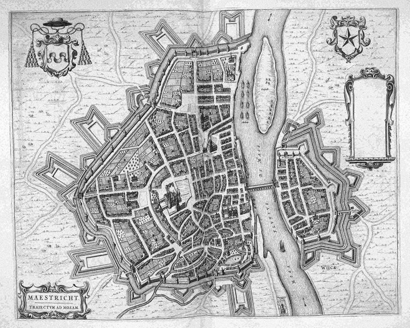
map of maastricht by willem and johannes blaeu (1649)
atlas beudeker
maps from the earth and its inhabitants, vol. xi
africa in the 1890s
maps from the earth and its inhabitants, vol. xi
africa in the 1890s
maps from the earth and its inhabitants, vol. xii
africa in the 1890s
africa in the 1890s
maps of africa
maps from the earth and its inhabitants, vol. xiii
africa in the 1890s
maps from the earth and its inhabitants, vol. xiii
maps of africa
maps from the earth and its inhabitants, vol. xiii
africa in the 1890s
maps from the earth and its inhabitants, vol. xii
africa in the 1890s
maps from the earth and its inhabitants, vol. xii
africa in the 1890s
maps from the earth and its inhabitants, vol. xii
africa in the 1890s
maps from the earth and its inhabitants, vol. xii
africa in the 1890s
maps from the earth and its inhabitants, vol. xiii
africa in the 1890s
maps from the earth and its inhabitants, vol. xii
africa in the 1890s
gemeente atlas van nederland - north holland
maps of beets, north holland
maps from the earth and its inhabitants, vol. xii
africa in the 1890s
maps from the earth and its inhabitants, vol. xi
africa in the 1890s
maps from the earth and its inhabitants, vol. xiii
africa in the 1890s
maps from the earth and its inhabitants, vol. xi
africa in the 1890s
maps from the earth and its inhabitants, vol. xiii
africa in the 1890s
maps from the earth and its inhabitants, vol. xii
africa in the 1890s
gemeente atlas van nederland - north holland
maps of venhuizen
topographia austriacarum (merian)
baroque
maps from the earth and its inhabitants, vol. xii
africa in the 1890s
maps from the earth and its inhabitants, vol. xi
africa in the 1890s
maps from the earth and its inhabitants, vol. xiii
africa in the 1890s
maps from the earth and its inhabitants, vol. xii
africa in the 1890s
maps from the earth and its inhabitants, vol. xii
africa in the 1890s
maps from the earth and its inhabitants, vol. xi
africa in the 1890s
maps from the earth and its inhabitants, vol. xi
africa in the 1890s
maps from the earth and its inhabitants, vol. xii
people of africa
maps from the earth and its inhabitants, vol. xii
africa in the 1890s
maps from the earth and its inhabitants, vol. xiii
africa in the 1890s
maps from the earth and its inhabitants, vol. xi
africa in the 1890s
maps from the earth and its inhabitants, vol. xii
africa in the 1890s
hemispheres centered south pole
manuscript maps
maps from the earth and its inhabitants, vol. xiii
maps of africa
old images of dadra and nagar haveli and daman and diu
maps of diu by braun & hogenberg
maps from the earth and its inhabitants, vol. xiii
africa in the 1890s
maps from the earth and its inhabitants, vol. xi
africa in the 1890s
curt teich postcard archives
map postcards
maps from the earth and its inhabitants, vol. xiii
africa in the 1890s
maps from the earth and its inhabitants, vol. xiii
africa in the 1890s
maps from the earth and its inhabitants, vol. xi
africa in the 1880s
eran laor cartographic collection
édouard hocquart
maps by willem and johannes blaeu
maps made in the 17th century
the dominion of portugal in africa (1889)
maps of cefala by braun & hogenberg
maps of dunkerque by braun & hogenberg
maps of bourbourg by braun & hogenberg
maps from gallica
baroque
maps in the library of congress
1863 maps of the united states
de praecipvis totivs vniversi vrbibvs, liber secvndvs (1575)
maps of dunkerque by braun & hogenberg
maps from university of amsterdam special collections
atlas der neederlanden
maps in the library of congress
old city hall (knoxville)
media from regionaal archief alkmaar
zuidschermer
eran laor cartographic collection
joris hoefnagel
17201 - 17300 of 38,646
Next page
/ 387