En
Log in
All resources
Create a design
Tools
38,646 Free Artworks of Map
john rocque
john rocque 1746 london map (a1-h3)
maps of africa
bibliothèque nationale de france
africa in the 1890s
maps in the library of congress
john rocque 1746 crops from library of congress
john rocque's maps of london
maps from the earth and its inhabitants, vol. xiii
eran laor cartographic collection
eran laor cartographic collection
cornelis de bruyn
maximilian friedrich weyhe
romanticism
map of paris by jouvin de rochefort (boutier 112)
maps of paris by françois de la pointe
herman diederik joan van schevichaven
revolt of the batavi
maps of africa in the robert c. williams paper museum
1665 maps of africa
1780 maps of the caribbean
maps by juan lopez
18th-century maps of hispaniola
maps by juan lopez
cartes de franz schrader
1894 maps of france
maps by wilhelm maximilian carpelan
zetterbergsvägen
ferrariae ducatus (galleria delle carte geografiche)
maps of hamburg by braun & hogenberg
1594 maps of hamburg
maps of edinburgh by braun & hogenberg
18th-century maps of scotland
gemeente atlas van nederland - north holland
old maps of monnickendam
maps of delft by braun & hogenberg
media from tu delft
maps from the earth and its inhabitants, vol. xi
africa in the 1890s
gemeente atlas van nederland - north holland
old maps of purmerend
gemeente atlas van nederland - north holland
maps of jisp
chicago and the midwest, newberry library
surveying in united states
john rocque 1746 london map (a1-h3)
john rocque
old maps of southeast asia
carolus allard
john rocque 1746 london map (a1-h3)
john rocque
john rocque 1746 london map (a1-h3)
john rocque
john rocque 1746 london map (a1-h3)
john rocque
john rocque 1746 london map (a1-h3)
john rocque
john rocque 1746 london map (a1-h3)
john rocque
cartes generales de toutes les parties du monde (1658)
1658 maps of asia
17th-century maps of the indian ocean
maps by willem and johannes blaeu
1744 maps of asia
baroque painting
cartes generales de toutes les parties du monde (1658)
maps by guillaume sanson
maps by jacques chiquet
1719 maps of africa
maps by jakob van der schley
old maps of southeast asia
eran laor cartographic collection
johann ulrich krauß
eran laor cartographic collection
joan blaeu
eran laor cartographic collection
johannes van den aveelen
maps from the earth and its inhabitants, vol. x
maps with nicolosi globular projection
john rocque 1746 london map (a1-h3)
john rocque
john rocque 1746 london map (a1-h3)
john rocque
john rocque 1746 london map (a1-h3)
john rocque
john rocque 1746 london map (a1-h3)
john rocque
john rocque 1746 london map (a1-h3)
john rocque
john rocque 1746 london map (a1-h3)
john rocque
john rocque 1746 london map (a1-h3)
john rocque
john rocque 1746 london map (a1-h3)
john rocque
1660s maps of the caribbean
tobago
ismailïa. a narrative of the expedition to central africa for the suppression of the slave trade (1874)
nyanza, rwanda
maps by alexis-hubert jaillot
old maps of the tyrol
eran laor cartographic collection
caspar merian
turgot map of paris, kyoto university library – derivative files
foire saint-laurent
maps by willem and johannes blaeu
maps of rügen by eilhard lubinus
maps of islands of sweden
björkö
surveying in the united states
1854 maps of california
plan de roussel - derivative files
château de bercy
maps of liège by johannes blaeu - derivative files
couvent des augustins de liège
media from regionaal archief alkmaar
winkel, north holland
maps from university of amsterdam special collections
atlas der neederlanden
maps from university of amsterdam special collections
atlas der neederlanden
maps from university of amsterdam special collections
atlas der neederlanden
the new forest, its history and its scenery
symbolism
carta hydrographica y chorographica de las yslas filipinas
baroque painting
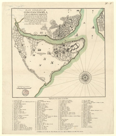
istanbul in the 1780s
maps by tomas lopez
old maps of the kingdom of naples
lago patria
maps by alexis-hubert jaillot
old maps of toulouse
maps of constantinople by braun & hogenberg
1570s maps of istanbul
map of ghent by jan blaeu
maps by frederick de wit
1600 world map by girolamo porro
leonardo cernoti
1600 world map by girolamo porro
leonardo cernoti
1600 world map by girolamo porro
leonardo cernoti
maps from the earth and its inhabitants, vol. x
old maps of the world
john rocque 1746 crops from library of congress
maps in the library of congress
john rocque 1746 crops from library of congress
maps in the library of congress
john rocque 1746 crops from library of congress
maps in the library of congress
john rocque 1746 crops from library of congress
maps in the library of congress
john rocque 1746 crops from library of congress
maps in the library of congress
john rocque 1746 crops from library of congress
maps in the library of congress
john rocque 1746 crops from library of congress
maps in the library of congress
description de l'universe
geography in the 1680s
maps by emanuel bowen
1740 maps
gallery of geographical maps (vatican museums)
fucine plain
accuratissima sliae fluminis descriptio
maps by johannes mejer
map of maastricht by willem and johannes blaeu (1649)
nieuwstad fortifications (maastricht)
maps of wales by humphrey llwyd
maps of beaumont by braun & hogenberg
maps by willem and johannes blaeu
old maps of capitanata
maps by petrus schenk
adorf/vogtl.
maps of portugal by fernando álvares seco
1760s maps of the americas
jean janvier
perris maps of manhattan published 1852–1853
centre market place (manhattan)
map of amsterdam, 1544
stadsarchief amsterdam
maps from the earth and its inhabitants, vol. xii
africa in the 1890s
maps from the earth and its inhabitants, vol. xi
africa in the 1890s
maps from the earth and its inhabitants, vol. xiii
africa in the 1890s
maps from the earth and its inhabitants, vol. xiii
africa in the 1890s
maps from the earth and its inhabitants, vol. xi
africa in the 1880s
maps from the earth and its inhabitants, vol. xiii
africa in the 1890s
maps from the earth and its inhabitants, vol. xiii
maps of africa
maps from the earth and its inhabitants, vol. xiii
africa in the 1890s
maps from the earth and its inhabitants, vol. xii
africa in the 1890s
maps from the earth and its inhabitants, vol. xiii
maps of africa
maps from the earth and its inhabitants, vol. xi
africa in the 1880s
maps from the earth and its inhabitants, vol. xiii
maps of africa
17101 - 17200 of 38,646
Next page
/ 387