En
Log in
All resources
Create a design
Tools
38,646 Free Artworks of Map
maps from the earth and its inhabitants, vol. x
1890 maps of africa
bibliothèque nationale de france
19th-century maps of east africa
joan blaeu
copper engraving print
maps by willem and johannes blaeu
maps from the earth and its inhabitants, vol. xii
atlas novus (blaeu)
british library
maps from university of amsterdam special collections
atlas der neederlanden
maps by alexis-hubert jaillot
maps by nicolas sanson
maps by willem and johannes blaeu
old maps of dordrecht
maps from the earth and its inhabitants, vol. xii
canary islands in the 1890s
maps of austro-prussian war
old maps of czechia
gemeente atlas van nederland - south holland
1860s maps of south holland
maps in the staats- und universitätsbibliothek hamburg
1852 maps of hamburg
maps of amersfoort by braun & hogenberg
maps by willem and johannes blaeu
theatre oft toonneel des aerdt-bodems (1571 kb)
maps of wales by humphrey llwyd
maps in the library of congress
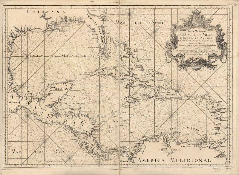
1755 maps
turgot map of paris, kyoto university library – derivative files
foire saint-germain on old maps
details of old maps of the united kingdom
cartouches by sanson family
map of ancient asia minor by philippe de la rué
1650s maps of turkey
historisk atlas (stockholm, norstedt & söner, 1880)
old maps of the polish-lithuanian commonwealth
media from the national library of finland
classicism
maps of krimpenerwaard
atlas novus (blaeu)
guide joanne normandie-1912
french-language maps
description de l'universe
old maps of karpathos
victor levasseur - maps of france
baroque
old maps of the british empire
illustrations by walter crane
homeros caetani (louvre ma440)
turgot map of paris, kyoto university library – derivative files
historical images of palais bourbon
paintings in the museu antônio parreiras
wood
eran laor cartographic collection
cartouches by joseph roux
maps of rivers of india
1886 maps of india
topographia westphaliae (merian)
baroque
cross of trier in heraldry
coats of arms on maps
history of attendorn
kloster ewig
atlas maior, vol 4 (netherlands) - joan blaeu, 1667 - bl 114.h(star).4
1667 maps
atlas maior, vol 12 (america) - joan blaeu, 1667 - bl 114.h(star).12
1667 maps
atlas maior, vol 6 (scotland and ireland) - joan blaeu, 1667 - bl 114.h(star).6
1667 maps
beschreibung der städt der welt - braun & hogenberg - btv1b52512111k
maps of mainz by braun & hogenberg
beschreibung der städt der welt - braun & hogenberg - btv1b52512111k
maps of dunkerque by braun & hogenberg
beschreibung der städt der welt - braun & hogenberg - btv1b52512111k
maps of groningen by braun & hogenberg
atlas maior, vol 2 (sweden, russia, poland, eastern europe, and greece) - joan blaeu, 1667 - bl 114.h(star).2
1667 maps of russia
maps in the library of congress
1750s maps of the caribbean
history of alphen aan den rijn
maps of aarlanderveen
e. a. wallis budge
1920 maps
maps by wilhelm maximilian carpelan
lidingöbro värdshus
19th-century maps of stockholm
prins eugens waldemarsudde
floor plans of fortresses
daugavgrīva castle
maps of groningen by braun & hogenberg
martinikerk (groningen)
midden-delfland in the 18th century
maps of midden-delfland
eran laor cartographic collection
maps of lyon by braun & hogenberg
maps of santander by braun & hogenberg
eran laor cartographic collection
de praecipvis totivs vniversi vrbibvs, liber secvndvs (1575)
maps of neuss by braun & hogenberg
maps from the earth and its inhabitants, vol. x
1890 maps of africa
maps from the earth and its inhabitants, vol. x
1890 maps of africa
maps from the earth and its inhabitants, vol. x
1890 maps of africa
maps from the earth and its inhabitants, vol. x
1890 maps of africa
maps from the earth and its inhabitants, vol. xi
africa in the 1890s
maps of the history of sweden
old maps of scandinavia
maps from the earth and its inhabitants, vol. x
1890 maps of africa
maps from the earth and its inhabitants, vol. x
1890s maps of egypt
maps from the earth and its inhabitants, vol. xi
africa in the 1890s
maps by christian sgrothen
old maps of north holland
gemeente atlas van nederland - south holland
1860s maps of south holland
maps from the earth and its inhabitants, vol. xii
canary islands in the 1890s
maps from the earth and its inhabitants, vol. xii
canary islands in the 1890s
maps by willem and johannes blaeu
old maps of gorinchem
the loyal west in the times of the rebellion (illinois)
cairo, illinois in the 1860s
a map of the british empire in america with the french and spanish settlements adjacent thereto
compass roses on maps
description de l'universe
1680s maps of italy
maps of asia by mercator-hondius
the cruise of the alice may in the gulf of st. lawrence and adjacent waters (1885) by benjamin
maps from the mechanical curator collection
old maps of the balearic islands
maps of spain by tomas lopez
parts of old maps of hamburg
maps of hamburg-sternschanze
encyclopédie méthodique - géographie physique
ambroise tardieu
maps of vangiones by sanson
1670s maps of hesse
map of the circle of austria by sanson
1700s maps of austria
maps by juan lopez
1835 maps of spain
expeditionis hispanorum in angliam vera descriptio anno domini mdlxxxviii
maps of the spanish armada
old maps of osnabrück
coats of arms on maps
maps by john cary
1811 maps
maps of the iberian peninsula by guillaume delisle
1700s maps of the iberian peninsula
map collection of leibniz-institut für länderkunde
maps of spain by tomas lopez
map collection of leibniz-institut für länderkunde
maps of spain by tomas lopez
french-language maps of the world
1700s maps of the world
maps from the earth and its inhabitants, vol. xii
africa in the 1890s
historical images of rapperswil-jona
topographischer atlas der schweiz
coats of arms of erbach family
coats of arms on maps
1771 maps of north america
multilingual maps
turgot map of paris, kyoto university library – derivative files
hôtel de condé
jan karel donatus van beecq
hernán cortés
1570s maps of north rhine-westphalia
1570s maps of lower saxony
topographischer atlas der schweiz
mur (dit) d'hannibal
drawings in the museu antônio parreiras
paper and graphite
cartouches by sanson family
monsters on maps
fra mauro map derivative works
thomas onwhyn
cartoons
maps by willem and johannes blaeu
old maps of zutphen
maps from the earth and its inhabitants, vol. x
1890 maps of africa
maps from the earth and its inhabitants, vol. x
1890 maps of africa
maps from the earth and its inhabitants, vol. x
1890 maps of africa
maps from the earth and its inhabitants, vol. x
1890 maps of africa
details of old maps of amsterdam
map of amsterdam, 1625
maps from the earth and its inhabitants, vol. x
1890 maps of africa
maps from the earth and its inhabitants, vol. x
1890 maps of africa
brazilian paintings in the museu antônio parreiras
antônio rafael pinto bandeira
atlas van der hagen (volume 4)
german renaissance
15001 - 15100 of 38,646
Next page
/ 387