En
Log in
All resources
Create a design
Tools
38,646 Free Artworks of Map
maps from the earth and its inhabitants, vol. x
gemeente atlas van nederland - south holland
1860s maps of south holland
copper engraving print
british library
joan blaeu
bibliothèque nationale de france
maps in the library of congress
gemeente atlas van nederland - north holland
1860s maps of north holland
california
maps
maps from the earth and its inhabitants, vol. x
1890 maps of africa
maps of ireland by baptista boazio
maps in the library of congress
maps from the earth and its inhabitants, vol. x
1890 maps of africa
gemeente atlas van nederland - south holland
1860s maps of south holland
maps from the earth and its inhabitants, vol. x
1890 maps of africa
gemeente atlas van nederland - south holland
maps of wassenaar
gemeente atlas van nederland - south holland
1860s maps of south holland
gemeente atlas van nederland - north holland
maps of muiden
maps from the earth and its inhabitants, vol. x
1890 maps of egypt
gemeente atlas van nederland - south holland
maps of kedichem
gemeente atlas van nederland - north holland
old maps of haarlem
gemeente atlas van nederland - north holland
maps of zandvoort
gemeente atlas van nederland - north holland
maps of bloemendaal
maps from the earth and its inhabitants, vol. x
1890 maps of africa
cornelis de jode
1579 maps
admiralty charts region r: usa and mexico west coasts
admiralty charts 401-600
maps from university of amsterdam special collections
atlas der neederlanden
cartography
maps
vrbivm praecipvarvm totivs mvndi liber tertivs (1616)
maps of walcourt by braun & hogenberg
david rumsey historical map collection
1790s maps of the holy roman empire
guide joanne espagne et portugal-1915
1915 maps
1780s maps of the caribbean
maps by tomas lopez
maps by tomas lopez
1785 maps
1780s maps of the caribbean
maps by juan lopez
maps by nicolaes visscher i
maps by daniel stoopendaal
maps of washington, north carolina
solon m. allis
16th-century maps of istanbul
ottoman istanbul in art
ambrosio spinola, marqués de los balbases
engravings by jacques callot
historisk atlas (stockholm, norstedt & söner, 1880)
maps of 13th-century germany
typus orbis terrarum
1570 maps of asia
maps in the library of congress
1852 maps
maps in the library of congress
1856 maps of philadelphia
maps from the mechanical curator collection
1760
paulownia tomentosa (cultivated in north america)
nrcs new york (state) distribution maps
maps of ghent by i. tirion
isaak tirion
gemeente atlas van nederland - south holland
old maps of delft
maps from the earth and its inhabitants, vol. x
maps of africa
maps from the earth and its inhabitants, vol. x
1890s maps of the nile delta
turgot map of paris, norman b. leventhal map center – derivative files
couvent des annonciades (paris)
media from accademia delle scienze di torino
high renaissance
paintings by antônio parreiras in the museu antônio parreiras
portrait paintings by antônio parreiras
gemeente atlas van nederland - south holland
1860s maps of south holland
atlas maior, vol 12 (america) - joan blaeu, 1667 - bl 114.h(star).12
1667 maps
atlas maior, vol 12 (america) - joan blaeu, 1667 - bl 114.h(star).12
1667 maps
atlas maior, vol 11 (asia) - joan blaeu, 1667 - bl 114.h(star).11
1667 maps
atlas maior, vol 12 (america) - joan blaeu, 1667 - bl 114.h(star).12
1667 maps
atlas maior, vol 9 (italy) - joan blaeu, 1667 - bl 114.h(star).9
1667 maps of italy
kingdom of bohemia (1627-1740)
17th-century maps of bohemia
eran laor cartographic collection
thesaurus philopoliticus
maps of liège by johannes blaeu - derivative files
palais curtius
atlas des anciens plans de paris by imprimerie nationale, 1880 from the musée carnavalet
maps of paris from paris musées
apsley cherry-garrard
edward wilson
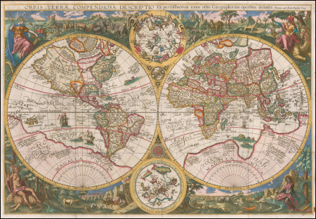
16th-century double hemisphere world maps
1590s maps of the world
turgot map of paris, david rumsey historical map collection – derivative files
historical images of église saint-sulpice
maps from university of amsterdam special collections
atlas der neederlanden
dr. wilh. junker's reisen in afrika 1875-1886
1880s maps of sudan
plan de paris levé par les ordres du roy, 1900
proletarian literature
africa and its inhabitants, vol. ii
charles eugène perron
maps in the library of congress
18th-century maps of sumatra
maps of london by john norden (1593)
maps by pieter van der keere
description de l'universe
old maps of andros
mappe-monde by guillaume delisle (18th century)
french-language maps of the world
john rocque 1746 crops from library of congress
maps in the library of congress
maps of the land of valkenburg
guillaume sanson
maps from the earth and its inhabitants, vol. xvii
anton francesco lucini
1650s maps of the americas
1658 maps
vrbivm praecipvarvm totivs mvndi liber tertivs (1616)
maps of venlo by braun & hogenberg
1780s maps of the caribbean
maps by tomas lopez
1600 world map by girolamo porro
leonardo cernoti
1600 world map by girolamo porro
leonardo cernoti
gemeente atlas van nederland - north holland
old maps of haarlem
maps from the earth and its inhabitants, vol. x
1890 maps of africa
maps from the earth and its inhabitants, vol. x
maps of port said
synopsis universae philologiae
1746 maps of asia
illustrations from the english lakes (1905)
maps of the lake district
avenionensis ditio et venaisinus comitatus (galleria delle carte geografiche)
maps in the library of congress
brookside mills
drawings in the museu antônio parreiras
paper and charcoal
drawings in the museu antônio parreiras
paper and graphite
media from accademia delle scienze di torino
1633 in rome
gemeente atlas van nederland - north holland
old maps of haarlem
gemeente atlas van nederland - south holland
maps of zegwaart
gemeente atlas van nederland - south holland
1860s maps of south holland
maps from the earth and its inhabitants, vol. xii
canary islands in the 1890s
german renaissance,northern renaissance
the ambassadors (holbein)
atlas maior, vol 9 (italy) - joan blaeu, 1667 - bl 114.h(star).9
1667 maps of italy
atlas maior, vol 9 (italy) - joan blaeu, 1667 - bl 114.h(star).9
1667 maps of italy
atlas maior, vol 8 (france ii and switzerland) - joan blaeu, 1667 - bl 114.h(star).8
1667 maps
beschreibung der städt der welt - braun & hogenberg - btv1b52512111k
maps of nîmes by braun & hogenberg
beschreibung der städt der welt - braun & hogenberg - btv1b52512111k
maps of heidelberg by braun & hogenberg
eran laor cartographic collection
willem blaeu
drawings in the museu antônio parreiras
india ink and watercolor
sanborn maps of manhattan published in 1904
wanamaker's (manhattan)
maps by petrus schenk
1750s maps of saxony
siberia and the exile system (1891)
maps of zabaykalsky krai
maps of london by braun & hogenberg
eran laor cartographic collection
middle ages in greece
maps of corfu town
maps of cefala by braun & hogenberg
national museum of tanzania
maps from university of amsterdam special collections
atlas der neederlanden
14901 - 15000 of 38,646
Next page
/ 387