En
Log in
All resources
Create a design
Tools
16,754 Free Images of Language
bibliothèque nationale de france
marco boschini
maps of the islands of greece by marco boschini (1658)
flora by h. witte (pngs)
chromolithograph
hortus botanicus leiden
abraham jacobus wendel
historical
history
cc-zero
maps of the islands of greece by marco boschini (1658)
history of kythnos
1690s maps of greece
maps from gallica
maps of the islands of greece by marco boschini (1658)
history of kalymnos
maps by willem and johannes blaeu
beausse
16th-century maps of crete
old maps of candia
old maps of milos
maps facing east
theatrum historium ad annum christi quadringentesinum by guillaume delisle (1705)
18th-century maps showing history
maps from gallica
old maps of paris
context files from gallica
history of andros
theatrum historium ad annum christi quadringentesinum by guillaume delisle (1705)
1740s maps showing history
maps of the islands of greece by marco boschini (1658)
history of patmos
maps by alexis-hubert jaillot
sanson maps of the holy land
maps of the islands of greece by marco boschini (1658)
context files from gallica
1710s maps of the world
maps by edward wright
historical
history
historical
history
landscape
building
historical
history
historical
history
historical
history
historical
history
historical
history
historical
history
map of the upper rhenian circle by sanson
maps by nicolas sanson
maps of spain by tomas lopez
1761 maps of spain
maps of spain by tomas lopez
1761 maps of spain
maps of the kingdom of córdoba (crown of castile)
maps of spain by tomas lopez
antoine-françois tardieu
maps from gallica
maps of cities in venezuela
maps by juan lopez
engravings by matthäus merian
baroque
charles-françois beautemps-beaupré
maps from gallica
1762 maps of north america
maps by tomas lopez
1800s maps of the iberian peninsula
maps of spain by tomas lopez
maps of the iberian peninsula by guillaume delisle
1700s maps of the iberian peninsula
character
ancient
ornament
heart
germany
flag
ornament
wine
maps of vienne by braun & hogenberg
maps of lyon by braun & hogenberg
a map of the british empire in america with the french and spanish settlements adjacent thereto
1730s maps of the caribbean
maps of the islands of greece by marco boschini (1658)
old maps of ios
bibliothèque nationale de france
guillaume sanson
bibliothèque nationale de france
braun/hogenberg dreizehn orte
maps by matthäus merian
baroque
maps of the islands of greece by marco boschini (1658)
old maps of anafi
ribes sanguineum - botanical illustrations
flora by h. witte (pngs)
maps of meldorf by braun & hogenberg
maps of heide by braun & hogenberg
maps by willem and johannes blaeu
17th-century maps of abruzzo
perspective de la ville de paris, veue du pont des tuileries - silvestre incidit - btv1b53181589j
bibliothèque nationale de france
bibliothèque nationale de france
1667 sanson map of africa
maps of the islands of greece by marco boschini (1658)
old maps of patmos
maps of the islands of greece by marco boschini (1658)
old maps of tilos
van langren map of southeast asia
1595 maps of asia
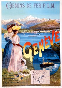
maps of lake geneva by jacques goulart
bibliothèque nationale de france
legousia speculum-veneris - botanical illustrations
flora by h. witte (pngs)
primula cortusoides - botanical illustrations
flora by h. witte (pngs)
maps of the islands of greece by marco boschini (1658)
old maps of alonissos
maps of ports and fortresses of the mediterranean by marco boschini (1651)
bibliothèque nationale de france
maps of mons (hainaut) by braun & hogenberg
maps of arras by braun & hogenberg
lychnis coronata - botanical illustrations
flora by h. witte (pngs)
maps of provence by pierre-jean de bompar
bibliothèque nationale de france
maps of dordrecht by braun & hogenberg
bibliothèque nationale de france
bibliothèque nationale de france
carolus allard
maps by willem and johannes blaeu
old maps of capitanata
maps of bourges by braun & hogenberg
maps of orléans by joris hoefnagel
expressionism
anton peschka
world war i posters in the library of congress
maximilian lenz
maps of ancient italy by philipp clüver
old maps of the alps
tricyrtis hirta - botanical illustrations
flora by h. witte (pngs)
crataegus orientalis - botanical illustrations
flora by h. witte (pngs)
maps of the islands of greece by marco boschini (1658)
old maps of kos
hydrangea macrophylla - botanical illustrations
flora by h. witte (pngs)
map of ancient asia minor by philippe de la rué
bibliothèque nationale de france
a topographical map of the county of berks (1761)
bibliothèque nationale de france
a map of the british empire in america with the french and spanish settlements adjacent thereto
1730s maps of the caribbean
china veteribus sinarum regio nunc incolis tame dicta
coats of arms on maps
china veteribus sinarum regio nunc incolis tame dicta
bibliothèque nationale de france
arnold van langren map of southwest africa
1596 maps of africa
maps of the islands of greece by marco boschini (1658)
old maps of nisyros
maps of the islands of greece by marco boschini (1658)
old maps of kalymnos
potentilla atrosanguinea - botanical illustrations
flora by h. witte (pngs)
euonymus latifolius - botanical illustrations
flora by h. witte (pngs)
perspective de la ville de paris, veue du pont des tuileries - silvestre incidit - btv1b53181589j
bibliothèque nationale de france
maps of the islands of greece by marco boschini (1658)
old maps of mykonos
maps of béthune by braun & hogenberg
bibliothèque nationale de france
16th-century maps of switzerland
ferrando bertelli
bibliothèque nationale de france
guillaume sanson
bibliothèque nationale de france
guillaume sanson
bibliothèque nationale de france
guillaume sanson
maps by johann baptist homann
sanson maps of the holy land
maps of munich by joris hoefnagel
bibliothèque nationale de france
maps of budapest by braun & hogenberg
maps of vienna by braun & hogenberg
narcissus hispanicus - botanical illustrations
flora by h. witte (pngs)
actinopterygii
animalia
eran laor cartographic collection
willem blaeu
athletics at the 1906 summer olympics
the olympic games at athens, 1906
eran laor cartographic collection
alexis-hubert jaillot
eran laor cartographic collection
alexis-hubert jaillot
1840s maps of the world
german renaissance
sanskrit-language manuscripts
19th-century manuscripts
13801 - 13900 of 16,754
Next page
/ 168