En
Log in
All resources
Create a design
Tools
38,646 Free Artworks of Map
bibliothèque nationale de france
tresor des cartes geographiques (1659)
beschreibung und contrafactur der vornembster stät der welt, liber primus civitates orbis terrarum
maps
cartography
jerusalem
fondo antiguo
cartografía
libros del siglo xvi
cartografía, mapas | cartography, maps
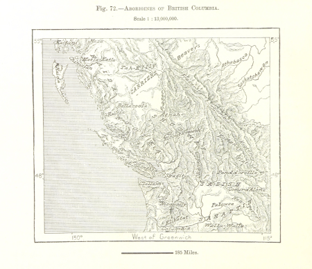
maps from the earth and its inhabitants, vol. xvi
surveying in mexico
maps from the earth and its inhabitants, vol. xvii
french louisiana
maps from the earth and its inhabitants, vol. x
lake tana
maps from the earth and its inhabitants, vol. ix
adana
maps from the earth and its inhabitants, vol. vi
pyatigorsk
maps from the earth and its inhabitants, vol. viii
ghats
maps from the earth and its inhabitants, vol. vii
yarlung tsangpo
maps from the earth and its inhabitants, vol. xv
first nations people of british columbia
maps from the earth and its inhabitants, vol. viii
british india
maps from the earth and its inhabitants, vol. x
rosetta (egypt)
maps from the earth and its inhabitants, vol. vii
qinghai lake
maps from the earth and its inhabitants, vol. xviii
transport in south america
maps from the earth and its inhabitants, vol. xvi
jorullo
demolished churches in de barbari map
santa maria dell'umiltà (venezia)
eran laor cartographic collection
giovanni maria cassini
eran laor cartographic collection
giovanni maria cassini
atlas - voyage pittoresque à l'île-de-france, au cap de bonne-espérance et à l'île de ténériffe (1812) by milbert
maps from the mechanical curator collection
françois de la pointe
maps of barbary coast
atlas minor gerardi mercatoris (1609)
maps of europe by mercator-hondius
old maps of spitsbergen
1642
de praecipvis totivs vniversi vrbibvs, liber secvndvs (1612)
maps of dunkerque by braun & hogenberg
maps by nicolaes visscher i
1660s maps of europe
nieuwe en beknopte hand-atlas (1754)
old maps of curaçao
atlas - voyage pittoresque à l'île-de-france, au cap de bonne-espérance et à l'île de ténériffe (1812) by milbert
maps from the mechanical curator collection
tresor des cartes geographiques (1659)
1650s maps of the americas
beschreibung und contrafactur der vornembster stät der welt, liber primus civitates orbis terrarum
maps of nîmes by braun & hogenberg
beschreibung und contrafactur der vornembster stät der welt, liber primus civitates orbis terrarum
maps of kassel by braun & hogenberg
tresor des cartes geographiques (1659)
1650s maps of france
beschreibung und contrafactur der vornembster stät der welt, liber primus civitates orbis terrarum
maps of genoa by braun & hogenberg
tresor des cartes geographiques (1659)
1659 maps of europe
beschreibung und contrafactur der vornembster stät der welt, liber primus civitates orbis terrarum
maps of wittenberg by braun & hogenberg
beschreibung und contrafactur der vornembster stät der welt, liber primus civitates orbis terrarum
maps of montpellier by braun & hogenberg
tresor des cartes geographiques (1659)
1650s maps of china
bibliothèque nationale de france
sanson map of lorraine
tresor des cartes geographiques (1659)
1650s maps of denmark
tresor des cartes geographiques (1659)
1650s maps of turkey
atlas vingboons
1665
maps from gallica
old maps of rome
maps by hendrik hondius the younger
1632 maps of africa
17th-century maps of savoie
old maps of savoie
mountains and lakes in cumberland and westmoreland (1808)
maps in the british museum
17th-century maps of the netherlands
maps by pieter van der keere
maps of the peloponnese by gerardus mercator
1640s maps of greece
engravings of topographia braunschweig lüneburg
baroque
prints by frans hogenberg in the rijksmuseum amsterdam
maps in the rijksmuseum amsterdam
maps from the earth and its inhabitants, vol. ix
old maps of samsun
maps of bremen by braun & hogenberg
maps made in the 16th century
old maps of galicia (spain)
1834 in galicia (spain)
beschreibung und contrafactur der vornembster stät der welt, liber primus civitates orbis terrarum
maps of toledo by braun & hogenberg
tresor des cartes geographiques (1659)
1650s maps of asia
beschreibung und contrafactur der vornembster stät der welt, liber primus civitates orbis terrarum
maps of würzburg by braun & hogenberg
tresor des cartes geographiques (1659)
1659 maps of africa
beschreibung und contrafactur der vornembster stät der welt, liber primus civitates orbis terrarum
maps of dresden by braun & hogenberg
tresor des cartes geographiques (1659)
1650s maps of hungary
tresor des cartes geographiques (1659)
1650s maps of greece
beschreibung und contrafactur der vornembster stät der welt, liber primus civitates orbis terrarum
maps of vienna by braun & hogenberg
beschreibung und contrafactur der vornembster stät der welt, liber primus civitates orbis terrarum
maps of rhodes by braun & hogenberg
beschreibung und contrafactur der vornembster stät der welt, liber primus civitates orbis terrarum
maps of lübeck by braun & hogenberg
tresor des cartes geographiques (1659)
1650s maps of italy
atlas ou representation du monde universel t. 2 (1633)
1630s maps of virginia
dutch 17th-century prints in the rijksmuseum amsterdam
maps by daniel stoopendaal
maps from university of amsterdam special collections
atlas der neederlanden
cartography
maps
cartography
maps
cartography
maps
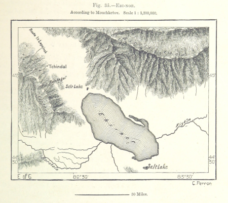
maps from the earth and its inhabitants, vol. vii
ebi lake
maps from the earth and its inhabitants, vol. vi
deserts of asia
maps from the earth and its inhabitants, vol. x
hannek
maps from the earth and its inhabitants, vol. vii
thomas edward gordon
maps from the earth and its inhabitants, vol. xvi
volcanism of mexico
maps from the earth and its inhabitants, vol. xii
sete cidades
maps from the earth and its inhabitants, vol. xviii
oscar drude
maps from the earth and its inhabitants, vol. v
skaptar-jokull
portrait paintings of men in the rijksmuseum amsterdam
american paintings in the rijksmuseum amsterdam
engraved maps
baroque
cartography
maps
cartography
maps
cartography
maps
cartography
maps
cartography
maps
cartography
maps
cartography
maps
old maps of the strait of gibraltar
hendrik de leth
maps published by hendrik de leth
algiers in the 18th century
sconces in the netherlands
maps by isaak tirion
old maps of southeast asia
maps by isaak tirion
johann heinrich schmidt (fornaro)
baroque
maps by pieter mortier
maps from gallica
1777 maps of south america
maps by thomas kitchin
egypt by david roberts
orientalism
carte de la mer méditerranée en trois feuilles (dheulland et al.)
18th-century maps of the western mediterranean
17th-century maps of xaintonge
maps by jodocus hondius ii
1762 maps of north america
maps by tomas lopez
theatrum orbis terrarum (1606 folger)
maps of wales by humphrey llwyd
maps from géographie illustrée de la france et de ses colonies
orientalist painting
historical maps of crema
borgo san pietro (crema)
1771 maps of asia
andrew dury
maps of besançon by braun & hogenberg
eran laor cartographic collection
maps in the national library of australia
map of paris by claes jansz. visscher
atlas ou representation du monde universel t. 2 (1633)
old maps of nuremberg
19801 - 19900 of 38,646
Next page
/ 387