En
Log in
All resources
Create a design
Tools
38,646 Free Artworks of Map
joan blaeu
copper engraving print
british library
1667 maps
eran laor cartographic collection
the comprehensive history of england (1876)
english-language maps showing history
1870s maps showing history
latin-language maps
atlas maior, vol 1 (northern europe, norway, and denmark) - joan blaeu, 1667 - bl 114.h(star).1
africa in the 1890s
maps of africa
geographia universalis (1545) in the british museum
german renaissance,northern renaissance
atlas maior, vol 8 (france ii and switzerland) - joan blaeu, 1667 - bl 114.h(star).8
1667 maps
maps from the earth and its inhabitants, vol. iv
kingsmead, bath
atlas maior, vol 2 (sweden, russia, poland, eastern europe, and greece) - joan blaeu, 1667 - bl 114.h(star).2
maps of candia by ortelius and mercator
maps from the earth and its inhabitants, vol. iii
old maps of bonn
atlas maior, vol 3 (germany) - joan blaeu, 1667 - bl 114.h(star).3
17th-century maps of silesia
atlas maior, vol 1 (northern europe, norway, and denmark) - joan blaeu, 1667 - bl 114.h(star).1
1667 maps
maps from the earth and its inhabitants, vol. xvi
1890s maps of belize
atlas maior, vol 1 (northern europe, norway, and denmark) - joan blaeu, 1667 - bl 114.h(star).1
1667 maps
atlas maior, vol 2 (sweden, russia, poland, eastern europe, and greece) - joan blaeu, 1667 - bl 114.h(star).2
17th-century maps of romania
atlas maior, vol 7 (france i) - joan blaeu, 1667 - bl 114.h(star).7
1667 maps
atlas maior, vol 7 (france i) - joan blaeu, 1667 - bl 114.h(star).7
1667 maps
atlas maior, vol 1 (northern europe, norway, and denmark) - joan blaeu, 1667 - bl 114.h(star).1
1667 maps
atlas maior, vol 3 (germany) - joan blaeu, 1667 - bl 114.h(star).3
17th-century maps of silesia
atlas maior, vol 4 (netherlands) - joan blaeu, 1667 - bl 114.h(star).4
1667 maps
atlas maior, vol 8 (france ii and switzerland) - joan blaeu, 1667 - bl 114.h(star).8
1667 maps
atlas maior, vol 1 (northern europe, norway, and denmark) - joan blaeu, 1667 - bl 114.h(star).1
1667 maps
maps from the earth and its inhabitants, vol. x
19th-century maps of cairo
the comprehensive history of england (1876)
english-language maps showing history
the comprehensive history of england (1876)
english-language maps showing history
the comprehensive history of england (1876)
english-language maps showing history
the comprehensive history of england (1876)
english-language maps showing history
the comprehensive history of england (1876)
english-language maps showing history
prints by mario cartaro
old maps of basilicata
travel maps of the united kingdom
australia (1873) by booth
maps by christian sgrothen
old maps of zeeland
maps of the iberian peninsula by mercator-hondius
maps by pieter van der keere
ceiling of the terrace of the geographical maps (uffizi gallery, florence)
mannerism
details of old maps of amsterdam
jan roodenpoortstoren
beschreibung der städt der welt - braun & hogenberg - btv1b52512111k
maps of cusco by braun & hogenberg
carte de moscovie by guillaume de l'isle (1706)
1700s maps of russia
maps by takeshiro matsuura
old maps of ezo
beschreibung der städt der welt - braun & hogenberg - btv1b52512111k
maps of burgos by braun & hogenberg
geographia universalis (1545) in the british museum
german renaissance,northern renaissance
geographia universalis (1545) in the british museum
german renaissance,northern renaissance
maps of the history of north america
saint paul island (alaska)
maps from university of amsterdam special collections
atlas der neederlanden
the comprehensive history of england (1876)
english-language maps showing history
the comprehensive history of england (1876)
english-language maps showing history
too late for gordon and khartoum (1887) by macdonald
maps of the mahdist war
the comprehensive history of england (1876)
english-language maps showing history
corona and coronet (1898)
1898 maps of the world
1870s maps of egypt
1879 maps of africa
maps of bamberg by braun & hogenberg
maps of bamberg by braun & hogenberg
maps of asia by mercator-hondius
maps of venlo by willem and johannes blaeu
distelmolen (venlo)
maps of asia by mercator-hondius
carte de l'amérique septentrionale by guillaume delisle (1700)
1700 maps of north america
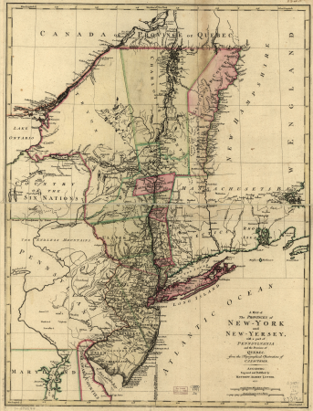
a map of the provinces of new york and new jersey, with a part of pennsylvania and the province of quebec
maps in the library of congress
maps by nicolas sanson
maps from gallica
plantae yucatanae. (regionis antillanae)
1903 in yucatán
1720s fashion
realism
1670s maps of rhineland-palatinate
maps of vangiones by sanson
nouvelle géographie universelle, vol. xvi
maps of holyoke, massachusetts
maps by willem and johannes blaeu
old maps of dunkerque
portrait paintings by giuseppe duprà (house of savoy)
portrait paintings of marie josephine louise of savoy
eran laor cartographic collection
william dickes
eran laor cartographic collection
theodor de bry
eran laor cartographic collection
pieter van der keere
eran laor cartographic collection
pieter van der keere
eran laor cartographic collection
william hughes (geographer)
historical images of bolivia
potosí
old maps of syracuse
pierre-adrien pâris
caribbean maps in leiden university library
files uploaded at wiki techstorm 2019
cartouches by alexis-hubert jaillot
maps by guillaume sanson
große eschenheimer straße
baroque
atlas maior, vol 9 (italy) - joan blaeu, 1667 - bl 114.h(star).9
1667 maps of italy
maps from the earth and its inhabitants, vol. xviii
1890s maps of peru
atlas maior, vol 7 (france i) - joan blaeu, 1667 - bl 114.h(star).7
17th-century maps of xaintonge
atlas maior, vol 7 (france i) - joan blaeu, 1667 - bl 114.h(star).7
1667 maps
maps from the earth and its inhabitants, vol. iv
ragstone
atlas maior, vol 1 (northern europe, norway, and denmark) - joan blaeu, 1667 - bl 114.h(star).1
1667 maps of europe
maps from the earth and its inhabitants, vol. xiv
maps of sumbawa
atlas maior, vol 9 (italy) - joan blaeu, 1667 - bl 114.h(star).9
1667 maps of italy
atlas maior, vol 9 (italy) - joan blaeu, 1667 - bl 114.h(star).9
1667 maps of italy
atlas maior, vol 3 (germany) - joan blaeu, 1667 - bl 114.h(star).3
17th-century maps of silesia
atlas maior, vol 1 (northern europe, norway, and denmark) - joan blaeu, 1667 - bl 114.h(star).1
1667 maps
atlas maior, vol 1 (northern europe, norway, and denmark) - joan blaeu, 1667 - bl 114.h(star).1
1667 maps
atlas maior, vol 8 (france ii and switzerland) - joan blaeu, 1667 - bl 114.h(star).8
1667 maps
atlas maior, vol 5 (england) - joan blaeu, 1667 - bl 114.h(star).5
17th-century maps of the british isles
atlas maior, vol 3 (germany) - joan blaeu, 1667 - bl 114.h(star).3
17th-century maps of silesia
maps from the earth and its inhabitants, vol. iv
amesbury
maps in the rijksmuseum amsterdam
johannes de ram
maps of gallipoli by braun & hogenberg
maps in the british museum
maps of bologna by braun & hogenberg
maps in the british museum
eran laor cartographic collection
willem blaeu
eran laor cartographic collection
willem blaeu
eran laor cartographic collection
romanticism
eran laor cartographic collection
willem blaeu
eran laor cartographic collection
romanticism
17th-century engravings
johannes de ram
eran laor cartographic collection
willem blaeu
eran laor cartographic collection
willem blaeu
speculum romanae magnificentiae (mirror of roman magnificence)
sebastiano del re
dominikanerkloster (frankfurt)
judengasse (frankfurt)
the comprehensive history of england (1876)
english-language maps showing history
the comprehensive history of england (1876)
english-language maps showing history
the comprehensive history of england (1876)
english-language maps showing history
19601 - 19700 of 38,646
Next page
/ 387