En
Log in
All resources
Create a design
Tools
38,646 Free Artworks of Map
joan blaeu
copper engraving print
british library
1667 maps
atlas maior, vol 1 (northern europe, norway, and denmark) - joan blaeu, 1667 - bl 114.h(star).1
africa in the 1890s
maps of africa
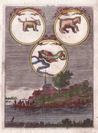
description de l'universe
alain manesson mallet
maps from the earth and its inhabitants, vol. xii
maps in the rijksmuseum amsterdam
maps by pieter mortier
maps from the earth and its inhabitants, vol. x
geography of egypt
maps from géographie illustrée de la france et de ses colonies
maps of isère
maps from the earth and its inhabitants, vol. xii
africa in the 1890s
maps from the earth and its inhabitants, vol. xii
africa in the 1890s
beschreibung der städt der welt - braun & hogenberg - btv1b52512111k
maps of mons (hainaut) by braun & hogenberg
maps of goa by linschoten
maps
old submaps of paris 1er arrondissement
plans of the palais-royal
coats of arms of grand duchy of lithuania
magni ducatus lithuaniae
geographia universalis (1545) in the british museum
german renaissance,northern renaissance
topographischer atlas der schweiz
eiger
old maps of the canton of zürich
türlersee
maps from the earth and its inhabitants, vol. iv
old maps of leeds
john rocque's 1746 map of london
old and new london (book)
maps from the earth and its inhabitants, vol. iv
old maps of lindisfarne
maps from the earth and its inhabitants, vol. iv
maps of the humber estuary
1770s maps of the caribbean
maps by thomas kitchin
atlas maior, vol 7 (france i) - joan blaeu, 1667 - bl 114.h(star).7
1667 maps
atlas maior, vol 1 (northern europe, norway, and denmark) - joan blaeu, 1667 - bl 114.h(star).1
1667 maps
atlas maior, vol 10 (spain and africa) - joan blaeu, 1667 - bl 114.h(star).10
1667 maps
atlas maior, vol 7 (france i) - joan blaeu, 1667 - bl 114.h(star).7
1667 maps
the history and antiquities of the parish of lambeth, and the archiepiscopal palace (1827)
1820s maps of london
atlas maior, vol 1 (northern europe, norway, and denmark) - joan blaeu, 1667 - bl 114.h(star).1
1667 maps
atlas maior, vol 11 (asia) - joan blaeu, 1667 - bl 114.h(star).11
1667 maps
atlas maior, vol 8 (france ii and switzerland) - joan blaeu, 1667 - bl 114.h(star).8
1667 maps
atlas maior, vol 6 (scotland and ireland) - joan blaeu, 1667 - bl 114.h(star).6
1667 maps
atlas maior, vol 7 (france i) - joan blaeu, 1667 - bl 114.h(star).7
1667 maps
atlas maior, vol 10 (spain and africa) - joan blaeu, 1667 - bl 114.h(star).10
1667 maps of africa
atlas maior, vol 8 (france ii and switzerland) - joan blaeu, 1667 - bl 114.h(star).8
1667 maps
atlas maior, vol 12 (america) - joan blaeu, 1667 - bl 114.h(star).12
1667 maps
atlas maior, vol 8 (france ii and switzerland) - joan blaeu, 1667 - bl 114.h(star).8
1667 maps
atlas maior, vol 7 (france i) - joan blaeu, 1667 - bl 114.h(star).7
1667 maps
atlas maior, vol 4 (netherlands) - joan blaeu, 1667 - bl 114.h(star).4
1667 maps
atlas maior, vol 4 (netherlands) - joan blaeu, 1667 - bl 114.h(star).4
1667 maps
atlas maior, vol 8 (france ii and switzerland) - joan blaeu, 1667 - bl 114.h(star).8
1667 maps
atlas maior, vol 1 (northern europe, norway, and denmark) - joan blaeu, 1667 - bl 114.h(star).1
1667 maps
atlas maior, vol 4 (netherlands) - joan blaeu, 1667 - bl 114.h(star).4
1667 maps
atlas maior, vol 1 (northern europe, norway, and denmark) - joan blaeu, 1667 - bl 114.h(star).1
1667 maps
atlas maior, vol 4 (netherlands) - joan blaeu, 1667 - bl 114.h(star).4
1667 maps
atlas maior, vol 1 (northern europe, norway, and denmark) - joan blaeu, 1667 - bl 114.h(star).1
1667 maps
atlas maior, vol 4 (netherlands) - joan blaeu, 1667 - bl 114.h(star).4
1667 maps
atlas maior, vol 8 (france ii and switzerland) - joan blaeu, 1667 - bl 114.h(star).8
1667 maps
atlas maior, vol 1 (northern europe, norway, and denmark) - joan blaeu, 1667 - bl 114.h(star).1
1667 maps
atlas maior, vol 7 (france i) - joan blaeu, 1667 - bl 114.h(star).7
1667 maps
atlas van loon
kuinderburcht
maps of cambridge by braun & hogenberg
cambridge castle
old maps of the rhine
neuburg am rhein
eran laor cartographic collection
giovanni maria cassini
bibliothèque nationale de france
guillaume sanson
sheets of stamps of russia, 2023
stamps of russia, 2023
gemeente atlas van nederland - utrecht
maps of houten
maps of bremen by braun & hogenberg
history of bremen cathedral
final report of the northwest territory celebration commission
1938 maps of the united states
heresies of sea power (fred t. jane)
fred t. jane
bibliothèque nationale de france
maps by thomas kitchin
maps in the stadsarchief amsterdam
maps by carolus allard
1870s maps of the atlantic ocean
the bottom of the sea (1870)
le antichità romane (piranesi)
neoclassicism
kurgans in serbia on topographic maps
luigi ferdinando marsigli
maps of bamberg by braun & hogenberg
maps of bamberg by braun & hogenberg
maps from the earth and its inhabitants, vol. iv
1880s maps of ireland
maps by jodocus hondius
maps by john speed
bodleian maps collection
1610s maps of the world
maps from the earth and its inhabitants, vol. xiii
africa in the 1890s
maps from the earth and its inhabitants, vol. xii
africa in the 1890s
africa in the 1890s
maps of africa
maps from the earth and its inhabitants, vol. xii
africa in the 1890s
maps from the earth and its inhabitants, vol. xiii
africa in the 1890s
maps from the earth and its inhabitants, vol. xii
africa in the 1890s
maps from the earth and its inhabitants, vol. xiii
africa in the 1890s
description de l'universe
africa in art
description de l'universe
africa in art
description de l'universe
constellations in art
description de l'universe
africa in art
description de l'universe
alain manesson mallet
description de l'universe
alain manesson mallet
map of the german empire by louis stanislas d'arcy de la rochette
1773 maps of the holy roman empire
description de l'universe
alain manesson mallet
19th-century maps of tasmania
australia (1873) by booth
maps made in the 17th century
novi belgii, atlas maior
grosser deutscher atlas
old maps of england
old maps of freiburg im breisgau
gregorius sickinger
old maps of the american civil war
francis d'avignon
maps from university of amsterdam special collections
atlas der neederlanden
atlas maior, vol 1 (northern europe, norway, and denmark) - joan blaeu, 1667 - bl 114.h(star).1
1667 maps
atlas maior, vol 1 (northern europe, norway, and denmark) - joan blaeu, 1667 - bl 114.h(star).1
1667 maps
atlas maior, vol 1 (northern europe, norway, and denmark) - joan blaeu, 1667 - bl 114.h(star).1
1667 maps
atlas maior, vol 6 (scotland and ireland) - joan blaeu, 1667 - bl 114.h(star).6
1667 maps
atlas maior, vol 7 (france i) - joan blaeu, 1667 - bl 114.h(star).7
1667 maps
atlas maior, vol 6 (scotland and ireland) - joan blaeu, 1667 - bl 114.h(star).6
1667 maps
atlas maior, vol 8 (france ii and switzerland) - joan blaeu, 1667 - bl 114.h(star).8
1667 maps
atlas maior, vol 12 (america) - joan blaeu, 1667 - bl 114.h(star).12
1667 maps
atlas maior, vol 2 (sweden, russia, poland, eastern europe, and greece) - joan blaeu, 1667 - bl 114.h(star).2
17th-century maps of greece
atlas maior, vol 2 (sweden, russia, poland, eastern europe, and greece) - joan blaeu, 1667 - bl 114.h(star).2
17th-century maps of hungary
atlas maior, vol 9 (italy) - joan blaeu, 1667 - bl 114.h(star).9
1667 maps of italy
atlas maior, vol 1 (northern europe, norway, and denmark) - joan blaeu, 1667 - bl 114.h(star).1
1667 maps
atlas maior, vol 6 (scotland and ireland) - joan blaeu, 1667 - bl 114.h(star).6
1667 maps
atlas maior, vol 9 (italy) - joan blaeu, 1667 - bl 114.h(star).9
1667 maps of italy
atlas maior, vol 1 (northern europe, norway, and denmark) - joan blaeu, 1667 - bl 114.h(star).1
1667 maps
19101 - 19200 of 38,646
Next page
/ 387