En
Log in
All resources
Create a design
Tools
38,646 Free Artworks of Map
africa in the 1890s
maps of africa
maps from the earth and its inhabitants, vol. iv
maps from the earth and its inhabitants, vol. xii
maps from the earth and its inhabitants, vol. xiii
bibliothèque nationale de france
maps from the earth and its inhabitants, vol. v
maps from the earth and its inhabitants, vol. xviii
maps from the earth and its inhabitants, vol. xi
tranquillo mollo
maps from the earth and its inhabitants, vol. xii
old maps of the canary islands
maps from the earth and its inhabitants, vol. xiv
population density maps of australia
maps from the earth and its inhabitants, vol. iv
19th-century maps of warwickshire
maps from the earth and its inhabitants, vol. iv
old maps of cheltenham
maps from the earth and its inhabitants, vol. iv
1870s maps of scotland
maps from the earth and its inhabitants, vol. xv
19th-century maps of quebec
maps from the earth and its inhabitants, vol. xv
maps of the gulf stream
maps from the earth and its inhabitants, vol. v
old maps of spitsbergen
maps from the earth and its inhabitants, vol. v
19th-century maps of copenhagen
maps from the earth and its inhabitants, vol. iv
maps of the north atlantic
maps from the earth and its inhabitants, vol. xiv
maps of hawaii island
maps from the earth and its inhabitants, vol. v
19th-century maps of saint petersburg
maps from the earth and its inhabitants, vol. iv
old maps of norwich
maps from the earth and its inhabitants, vol. xviii
maps of agriculture in colombia
maps from the earth and its inhabitants, vol. xvi
maps of weather and climate of mexico
maps from the earth and its inhabitants, vol. xv
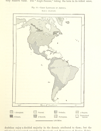
linguistic maps of the americas
maps from the earth and its inhabitants, vol. iv
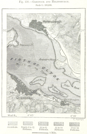
maps of the firth of clyde
maps from the earth and its inhabitants, vol. viii
old maps of mumbai
maps from the earth and its inhabitants, vol. iv
old maps of glasgow
maps from the earth and its inhabitants, vol. xi
1870s maps of morocco
maps from the earth and its inhabitants, vol. xviii
old maps of bogotá
maps from the earth and its inhabitants, vol. iv
old maps of derby
maps from the earth and its inhabitants, vol. v
19th-century maps of stockholm
maps from the earth and its inhabitants, vol. v
19th-century maps of saint petersburg
maps from the earth and its inhabitants, vol. xi
1870s maps of algeria
maps from the earth and its inhabitants, vol. xii
old maps of cameroon
maps from the earth and its inhabitants, vol. iv
old maps of aberdeen
maps from the earth and its inhabitants, vol. xii
old maps of the canary islands
maps from the earth and its inhabitants, vol. x
religion maps of africa
maps from the earth and its inhabitants, vol. iv
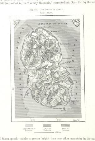
old maps of the isle of arran
maps from the earth and its inhabitants, vol. xviii
old maps of curaçao
maps from the earth and its inhabitants, vol. xi
old maps of algeria
maps from the earth and its inhabitants, vol. xvii
maps of the tennessee river
maps from the earth and its inhabitants, vol. iv
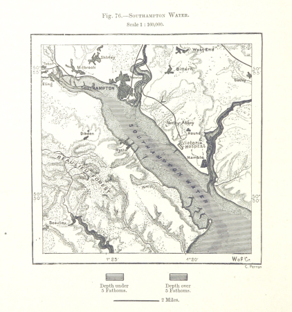
old maps of southampton
maps from the earth and its inhabitants, vol. xii
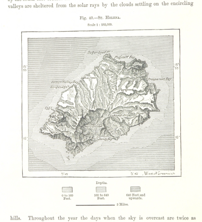
old maps of saint helena
maps from the earth and its inhabitants, vol. xiii
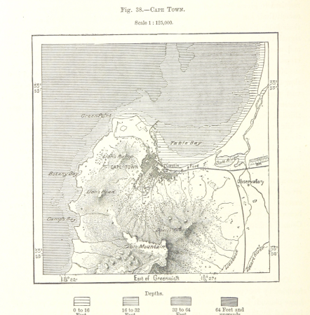
old maps of cape town
maps from the earth and its inhabitants, vol. xvii
19th-century maps of san francisco
maps from the earth and its inhabitants, vol. x
maps of weather and climate of africa
maps from the earth and its inhabitants, vol. xvi
archaeological maps of mexico
maps from the earth and its inhabitants, vol. xv
maps of ocean currents
maps from the earth and its inhabitants, vol. xii
old maps of tenerife
maps from the earth and its inhabitants, vol. iv
old maps of portsmouth
maps from the earth and its inhabitants, vol. xviii
maps of weather and climate of south america
maps from the earth and its inhabitants, vol. iv
old maps of the shetland islands
maps from the earth and its inhabitants, vol. xviii
old maps of bogotá
maps from the earth and its inhabitants, vol. xvi
19th-century maps of guadeloupe
maps from the earth and its inhabitants, vol. viii
topographic maps of sri lanka
maps from the earth and its inhabitants, vol. iv
maps of st kilda
maps from the earth and its inhabitants, vol. iii
population density maps of europe
arnold's geographical handbook (1899)
maps of river clyde
arnold's geographical handbook (1899)
1890s maps of england
arnold's geographical handbook (1899)
maps of the panama canal
cartography
maps
maps by willem and johannes blaeu
1630s maps of the americas
maps in the rijksmuseum amsterdam
johannes leupenius
eran laor cartographic collection
tranquillo mollo
maps from the earth and its inhabitants, vol. xiii
africa in the 1890s
maps from the earth and its inhabitants, vol. xii
africa in the 1890s
maps from the earth and its inhabitants, vol. xiii
africa in the 1890s
maps from the earth and its inhabitants, vol. xi
africa in the 1890s
maps from the earth and its inhabitants, vol. xii
africa in the 1890s
maps from the earth and its inhabitants, vol. xiii
africa in the 1890s
historical images of église saint-nicolas-du-chardonnet
map of paris by braun & hogenberg - derivative files
maps from the earth and its inhabitants, vol. xiii
africa in the 1890s
maps from the earth and its inhabitants, vol. xii
africa in the 1890s
maps from the earth and its inhabitants, vol. xii
africa in the 1890s
maps from the earth and its inhabitants, vol. xiii
africa in the 1890s
maps from the earth and its inhabitants, vol. xi
africa in the 1890s
maps from the earth and its inhabitants, vol. xii
africa in the 1890s
maps from the earth and its inhabitants, vol. xii
africa in the 1890s
maps in the rijksmuseum amsterdam
old maps of tholen
ceiling of the terrace of the geographical maps (uffizi gallery, florence)
maps of fortress of charlemont by braun & hogenberg
maps of givet and charlemont city walls
gemeente atlas van nederland - drenthe
maps of de wolden
mappa geographica novissima regni hungariae, - divisi in suos comitatus cum districtibus jazygum et cumanorum banatus temesiensis ejusque districtuum nec non regnorum croatiae sclavoniae dalmatiae magni... - btv1b532332906
tranquillo mollo
mappa geographica novissima regni hungariae, - divisi in suos comitatus cum districtibus jazygum et cumanorum banatus temesiensis ejusque districtuum nec non regnorum croatiae sclavoniae dalmatiae magni... - btv1b532332906
tranquillo mollo
mappa geographica novissima regni hungariae, - divisi in suos comitatus cum districtibus jazygum et cumanorum banatus temesiensis ejusque districtuum nec non regnorum croatiae sclavoniae dalmatiae magni... - btv1b532332906
tranquillo mollo
maps in the library of congress
1779 maps of new york (state)
mappa geographica novissima regni hungariae, - divisi in suos comitatus cum districtibus jazygum et cumanorum banatus temesiensis ejusque districtuum nec non regnorum croatiae sclavoniae dalmatiae magni... - btv1b532332906
tranquillo mollo
eran laor cartographic collection
adolf eltzner
dr. wilh. junker's reisen in afrika 1875-1886
1889 maps of sudan
cornelius aurelius world map
1510s maps of north america
a voyage to abyssinia, and travels into the interior of that country, executed under the orders of the british government in the years 1809 & 1810
john outhett
maps of haussmann's renovation of paris
rue de médicis (paris)
maps of haussmann's renovation of paris
rue de médicis (paris)
maps of the iberian peninsula by guillaume delisle
eran laor cartographic collection
atlas de jacoubet, bibliothèque historique de la ville de paris
proletarian literature
old maps of ischia (island)
giulio jasolino
drawings by jan veth in the rijksmuseum amsterdam
book covers in the rijksmuseum amsterdam
map of ancient assyria by philippe de la rué
old maps of mesopotamia
maps in the library of congress
1660s maps of the americas
maps by pieter van der keere
1598 maps of italy
maps of portugal by fernando álvares seco
kingdom of the algarve
maps of heidelberg by braun & hogenberg
gaisberg of heidelberg
maps of bremen by braun & hogenberg
bremen in the 16th century
topographia franconiae (merian)
baroque
eran laor cartographic collection
latin-language maps
maps of genoa by braun & hogenberg
maps in the british museum
maps from the earth and its inhabitants, vol. xiii
africa in the 1890s
maps from the earth and its inhabitants, vol. xiii
africa in the 1890s
18701 - 18800 of 38,646
Next page
/ 387