En
Log in
All resources
Create a design
Tools
38,646 Free Artworks of Map
copper engraving print
british library
joan blaeu
maps from the earth and its inhabitants, vol. iv
1667 maps
atlas maior, vol 9 (italy) - joan blaeu, 1667 - bl 114.h(star).9
1667 maps of italy
atlas maior, vol 4 (netherlands) - joan blaeu, 1667 - bl 114.h(star).4
maps from the earth and its inhabitants, vol. xii
maps from the earth and its inhabitants, vol. v
atlas maior, vol 4 (netherlands) - joan blaeu, 1667 - bl 114.h(star).4
1667 maps
atlas maior, vol 1 (northern europe, norway, and denmark) - joan blaeu, 1667 - bl 114.h(star).1
1667 maps
atlas maior, vol 9 (italy) - joan blaeu, 1667 - bl 114.h(star).9
1667 maps of italy
atlas maior, vol 8 (france ii and switzerland) - joan blaeu, 1667 - bl 114.h(star).8
1667 maps
atlas maior, vol 4 (netherlands) - joan blaeu, 1667 - bl 114.h(star).4
1667 maps
atlas maior, vol 9 (italy) - joan blaeu, 1667 - bl 114.h(star).9
1667 maps of italy
atlas maior, vol 8 (france ii and switzerland) - joan blaeu, 1667 - bl 114.h(star).8
1667 maps
atlas maior, vol 6 (scotland and ireland) - joan blaeu, 1667 - bl 114.h(star).6
1667 maps
atlas maior, vol 10 (spain and africa) - joan blaeu, 1667 - bl 114.h(star).10
1667 maps
atlas maior, vol 7 (france i) - joan blaeu, 1667 - bl 114.h(star).7
1667 maps
atlas maior, vol 9 (italy) - joan blaeu, 1667 - bl 114.h(star).9
1667 maps of italy
atlas maior, vol 4 (netherlands) - joan blaeu, 1667 - bl 114.h(star).4
1667 maps
atlas maior, vol 9 (italy) - joan blaeu, 1667 - bl 114.h(star).9
1667 maps of italy
atlas maior, vol 9 (italy) - joan blaeu, 1667 - bl 114.h(star).9
1667 maps of italy
situs terrae promissionis by christian van adrichom
old maps of the stations of the exodus
atlas maior, vol 9 (italy) - joan blaeu, 1667 - bl 114.h(star).9
1667 maps of italy
atlas maior, vol 4 (netherlands) - joan blaeu, 1667 - bl 114.h(star).4
1667 maps
atlas maior, vol 6 (scotland and ireland) - joan blaeu, 1667 - bl 114.h(star).6
1667 maps
atlas maior, vol 6 (scotland and ireland) - joan blaeu, 1667 - bl 114.h(star).6
1667 maps
atlas maior, vol 10 (spain and africa) - joan blaeu, 1667 - bl 114.h(star).10
1667 maps
maps by pieter van der keere
southwark, london
atlas maior, vol 4 (netherlands) - joan blaeu, 1667 - bl 114.h(star).4
1667 maps
old maps of milan
domenico aspari
maps from the earth and its inhabitants, vol. xii
africa in the 1890s
algiers in the 19th century
old maps of algiers
a plan of the operations of the king's army under the command of general sr. william howe, k.b. in new york and east new jersey, against the american forces commanded by general washington, from the 12th. of october, to the 28th. of november 1776
battle of white plains
maps from the earth and its inhabitants, vol. iv
old maps of dublin
maps from the earth and its inhabitants, vol. iv
maps of the north atlantic
maps from the earth and its inhabitants, vol. xv
maps of niagara falls, new york
maps from the earth and its inhabitants, vol. iv
old maps of liverpool
maps from the earth and its inhabitants, vol. xi
demographic maps of libya
maps from the earth and its inhabitants, vol. v
old maps of the faroe islands
maps from the earth and its inhabitants, vol. viii
old maps of kolkata
maps from the earth and its inhabitants, vol. v
19th-century maps of crimea
maps from the earth and its inhabitants, vol. iv
old maps of dublin
maps from the earth and its inhabitants, vol. xvi
maps of the history of mexico
maps from the earth and its inhabitants, vol. xiv
old maps of antarctica
maps from the earth and its inhabitants, vol. ix
religion maps of asia
maps from the earth and its inhabitants, vol. x
maps of lake victoria
maps from the earth and its inhabitants, vol. iii
old maps of the rhine
maps from the earth and its inhabitants, vol. iv
maps of the british isles
maps from the earth and its inhabitants, vol. xv
climate maps of alaska
maps from the earth and its inhabitants, vol. iv
1870s maps of the british isles
maps from the earth and its inhabitants, vol. iv
old maps of hadrian's wall
maps from the earth and its inhabitants, vol. iv
maps of ben nevis
maps from the earth and its inhabitants, vol. iv
1870s maps of the british isles
maps from the earth and its inhabitants, vol. xvi
population density maps of mexico
maps from the earth and its inhabitants, vol. iv
maps of holy loch
maps from the earth and its inhabitants, vol. xi
old maps of carthage
maps from the earth and its inhabitants, vol. xi
1870s maps of morocco
maps from the earth and its inhabitants, vol. iv
maps of the river severn
maps from the earth and its inhabitants, vol. xvi
maps of the yucatan peninsula
maps from the earth and its inhabitants, vol. xii
bathymetric maps of the atlantic ocean
maps from the earth and its inhabitants, vol. xvii
old maps of cape cod
maps from the earth and its inhabitants, vol. vii
old maps of tokyo
maps from the earth and its inhabitants, vol. xv
demographic maps of the americas
maps from the earth and its inhabitants, vol. iv
19th-century maps of cumberland
maps from the earth and its inhabitants, vol. xvii
1870s maps of the united states
maps from the earth and its inhabitants, vol. vii
ethnographic maps of asia
maps from the earth and its inhabitants, vol. xii
old maps of cameroon
maps from the earth and its inhabitants, vol. x
linguistic maps of africa
maps from the earth and its inhabitants, vol. xii
19th-century maps of the azores
maps from the earth and its inhabitants, vol. viii
old maps of mumbai
maps from the earth and its inhabitants, vol. xvii
old maps of martha's vineyard
maps from the earth and its inhabitants, vol. iv
old maps of salisbury
maps from the earth and its inhabitants, vol. ix
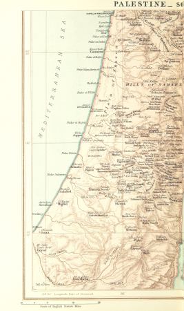
1870s maps of palestine
maps from the earth and its inhabitants, vol. vi
ethnographic maps of asia
maps from the earth and its inhabitants, vol. iv
19th-century maps of lancashire
maps from the earth and its inhabitants, vol. vii
old maps of beijing
maps from the earth and its inhabitants, vol. iv
old maps of perth, scotland
maps from the earth and its inhabitants, vol. v
old maps of the black sea
maps from the earth and its inhabitants, vol. xii
maps of tristan da cunha
maps from the earth and its inhabitants, vol. xviii
old maps of caracas
maps from the earth and its inhabitants, vol. iii
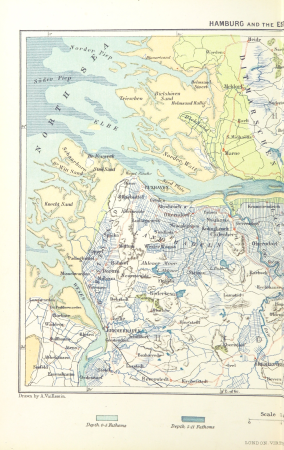
old maps of hamburg
maps from the earth and its inhabitants, vol. iii
1870s maps of berlin
maps from the earth and its inhabitants, vol. iii
1870s maps of berlin
maps from the earth and its inhabitants, vol. xv
maps of niagara falls, new york
maps from the earth and its inhabitants, vol. vii
ethnographic maps of asia
maps from the earth and its inhabitants, vol. iv
19th-century maps of cambridgeshire
maps from the earth and its inhabitants, vol. iv
old maps of birmingham
maps from the earth and its inhabitants, vol. ix
demographic maps of afghanistan
maps from the earth and its inhabitants, vol. xvii
old maps of the mississippi delta
maps from the earth and its inhabitants, vol. v
maps of jan mayen
maps from the earth and its inhabitants, vol. vi
ethnographic maps of asia
maps from the earth and its inhabitants, vol. xvi
19th-century maps of havana
maps from the earth and its inhabitants, vol. iv
old maps of brighton
maps from the earth and its inhabitants, vol. viii
linguistic maps of india
maps from the earth and its inhabitants, vol. v
19th-century maps of stockholm
admiralty charts 2601-2800
tralee
eran laor cartographic collection
tranquillo mollo
historical images of lucknow
edward weller
maps from the earth and its inhabitants, vol. xiii
africa in the 1890s
bruxella nobilissima brabantiae civitas an° 1640
port of brussels
historical images of lucknow
edward weller
cartouches by sanson family
pierre mariette i
gemeente atlas van nederland - gelderland
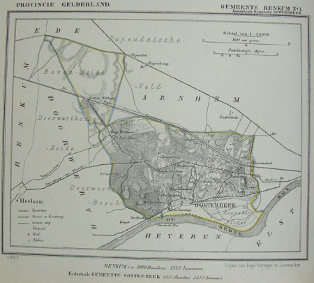
maps of renkum
french-language maps
daniel de la feuille
people with maps in art
posters of germany
maps of groningen by braun & hogenberg
history of martinikerk (groningen)
geographia universalis (1545) in the british museum
german renaissance,northern renaissance
18301 - 18400 of 38,646
Next page
/ 387