En
Log in
All resources
Create a design
Tools
38,646 Free Artworks of Map
africa in the 1890s
maps of africa
bibliothèque nationale de france
eran laor cartographic collection
maps from the earth and its inhabitants, vol. xii
joan blaeu
maps in the library of congress
maps from the earth and its inhabitants, vol. xiii
maps from the earth and its inhabitants, vol. xi
latin-language maps
maps of 's-hertogenbosch by braun & hogenberg
maps of leuven by braun & hogenberg
portrait paintings by michele gordigiani
scapigliatura
eran laor cartographic collection
tranquillo mollo
house of arenberg
parks in belgium
old maps of genoa
nicolò armanino
turgot map of paris – derivative files
abbaye de montmartre
cartouches by willem and johannes blaeu
people of turkey in art
maps by willem and johannes blaeu
old maps of purmerend
maps of wales by humphrey llwyd
theatrum orbis terrarum
lawrence h. slaughter collection of english maps, charts, globes, books and atlases
nypl lionel pincus and princess firyal map division
maps of the hague by braun & hogenberg
1666 in the hague
a map of the provinces of new york and new jersey, with a part of pennsylvania and the province of quebec
maps in the library of congress
historical images of palais des princes-evêques de liège
maps by willem and johannes blaeu
norwegian north-atlantic expedition (1876-1878)
old maps of jan mayen
media from regionaal archief alkmaar
sint pancras
de praecipvis totivs vniversi vrbibvs, liber secvndvs (1575)
maps of tunis by braun & hogenberg
maps of saint paul's journeys
maps by pieter van der keere
town of bamberg (world heritage site)
maps of bamberg by braun & hogenberg
situs terrae promissionis by christian van adrichom
eran laor cartographic collection
maps from the earth and its inhabitants, vol. x
maps of uganda
maps from the earth and its inhabitants, vol. xiv
maps of australia
maps from the earth and its inhabitants, vol. ix
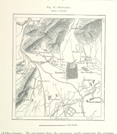
maps of kandahar
maps from the earth and its inhabitants, vol. ix
maps of the tigris
maps from the earth and its inhabitants, vol. v
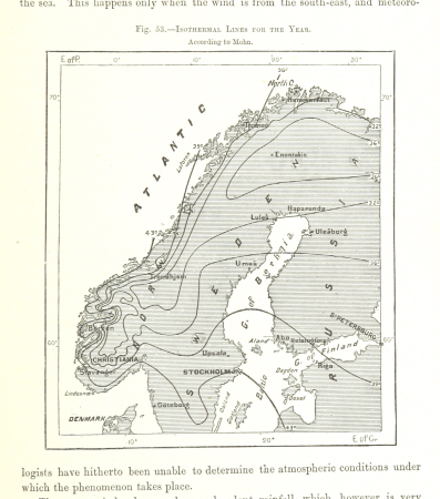
maps of scandinavia
maps from the earth and its inhabitants, vol. iii
maps of the rhine
hofgartenstraße (düsseldorf)
romanticism
old maps of the moon
tobias mayer
carte de partie de lithuanie (north belarus, polazk) by nicolas sanson
cartouches by sanson family
topographischer atlas der schweiz
maps of glaciers of switzerland
lucas janszoon waghenaer
1580s maps of spain
maps from the earth and its inhabitants, vol. xii
africa in the 1890s
maps from the earth and its inhabitants, vol. xiii
africa in the 1890s
maps from the earth and its inhabitants, vol. xii
africa in the 1890s
maps from the earth and its inhabitants, vol. xii
africa in the 1890s
maps from the earth and its inhabitants, vol. xi
africa in the 1890s
maps from the earth and its inhabitants, vol. xiii
maps of africa
maps from the earth and its inhabitants, vol. xi
africa in the 1890s
maps from the earth and its inhabitants, vol. xii
africa in the 1890s
maps from the earth and its inhabitants, vol. xii
africa in the 1890s
maps of ghent by armand heins
old maps of ghent
maps from the earth and its inhabitants, vol. xii
africa in the 1890s
maps from the earth and its inhabitants, vol. xii
africa in the 1890s
maps from the earth and its inhabitants, vol. xi
africa in the 1890s
maps from the earth and its inhabitants, vol. xiii
maps of africa
maps from the earth and its inhabitants, vol. xii
africa in the 1890s
maps from the earth and its inhabitants, vol. xi
africa in the 1890s
maps from the earth and its inhabitants, vol. xiii
africa in the 1890s
maps from the earth and its inhabitants, vol. xii
africa in the 1890s
old maps of genoa
nicolò armanino
maps by louis brion de la tour
1786 maps of africa
arts and crafts movement
eric gill
maps
sea
antoine-françois tardieu
maps from gallica
antoine-françois tardieu
maps from gallica
new bern, north carolina
solon m. allis
engravings of topographia braunschweig lüneburg
baroque
maps in the library of congress
propaganda map
1782 maps of the caribbean
maps by juan lopez
sanson maps of the netherlands
1700s maps of the netherlands
eran laor cartographic collection
joan blaeu
eran laor cartographic collection
william hughes (geographer)
gemeente atlas van nederland - south holland
polytechnische school te delft
maps from university of amsterdam special collections
atlas der neederlanden
maps from university of amsterdam special collections
atlas der neederlanden
maps from university of amsterdam special collections
atlas der neederlanden
maps from university of amsterdam special collections
atlas der neederlanden
new york and brooklyn, with jersey city and hoboken water front
maps in the library of congress
maps of paris from the david rumsey historical map collection
environs de paris levés géométriquement by jean delagrive
maps from the mechanical curator collection available to georeference
maps from the mechanical curator collection
shadows of the east; or, slight sketches of scenery, persons and customs, from observations during a tour in 1853 and 1854, in egypt, palestine, syria, turkey, and greece (1855) by tobin
maps of upper egypt
16th-century maps of amsterdam
amsterdam in the 1590s
historical images of lucknow
edward weller
geographia universalis (1545) in the british museum
german renaissance,northern renaissance
demolished churches in de barbari map
santi filippo e giacomo (venice)
maps by jakob van der schley
1750s maps of taiwan
maps of blois by braun & hogenberg
carte de partie de lithuanie (east belarus, northern ukraine) by nicolas sanson
cartouches by sanson family
new york and brooklyn, with jersey city and hoboken water front
maps in the library of congress
1750s maps of california
1705 maps of california
maps of cairo by braun & hogenberg
matteo pagano della fede
maps of paris from the university of wisconsin-milwaukee libraries
map of paris by claes jansz. visscher
15th-century maps of the caucasus
fra mauro map details
maps of westmorland and man by gerardus mercator
ateliers bmb mercator
17th-century maps of southeast asia
description de l'universe
description de l'universe
old maps of africa
17th-century maps of southeast asia
description de l'universe
18th-century maps of southeast asia
description de l'universe
birdcraft (1903, macmillan company)
illustrations of birds
historical images of lucknow
edward weller
maps by pieter mortier
le neptune francois
old maps of enkhuizen
atlas van loon
illustrations from découverte de la terre
jacques cartier by théophile hamel
eran laor cartographic collection
german renaissance,humanism
eran laor cartographic collection
cornelis de bruyn
eran laor cartographic collection
joan blaeu
eran laor cartographic collection
joan blaeu
eran laor cartographic collection
william hole (engraver)
eran laor cartographic collection
william hole (engraver)
atlas maior, vol 9 (italy) - joan blaeu, 1667 - bl 114.h(star).9
1667 maps of italy
atlas maior, vol 8 (france ii and switzerland) - joan blaeu, 1667 - bl 114.h(star).8
1667 maps
18101 - 18200 of 38,646
Next page
/ 387