En
Log in
All resources
Create a design
Tools
38,646 Free Artworks of Map
africa in the 1890s
maps of africa
bibliothèque nationale de france
maps from the earth and its inhabitants, vol. xiii
maps from the earth and its inhabitants, vol. xii
eran laor cartographic collection
maps from the earth and its inhabitants, vol. xi
baroque
french-language maps
maps in the library of congress
maps of hamburg by braun & hogenberg
maps of lübeck by braun & hogenberg
maps in the library of congress
1776 maps
old maps of rovigo
francesco zucchi
de wikisource book leaflet
de nordseeküste (karten)
old maps of saint-louis (senegal)
orientalist painting
cartes de franz schrader
1894 maps of france
eran laor cartographic collection
antonio lafreri
eran laor cartographic collection
willem blaeu
collège de lisieux
collège du plessis
old maps of georgia (u.s. state)
maps in the library of congress
1651 maps of baden-württemberg
house of helfenstein
old maps of namur (province)
1640s maps of belgium
17th-century maps of switzerland
maps by pieter van der keere
18th-century maps of crimea
1780s maps of ukraine
cartouches by sanson family
pierre mariette i
atlas maior, vol 6 (scotland and ireland) - joan blaeu, 1667 - bl 114.h(star).6
1667 maps
eran laor cartographic collection
baroque
maps from géographie illustrée de la france et de ses colonies
orientalist painting
maps of the spanish-american war
1890s maps of the philippines
the antiquities of england and wales (1773)
1773 fleurons
strasbourg in the 17th century
old maps of strasbourg
17th-century maps of herefordshire
llancillo
the antiquities of england and wales (1773)
1773 fleurons
maps of stade
baroque
media from regionaal archief alkmaar
broek op langedijk
1730s maps of the americas
1730s maps
le neptune francois
charles pène 8th
thomas milton
1739 maps
maps by willem and johannes blaeu
robert gordon of straloch
charles william meredith van de velde
eran laor cartographic collection
atlas of the great elector
archipelagus orientalis
maps by jakob van der schley
old maps of southeast asia
maps of constantinople by braun & hogenberg
1570s maps of istanbul
1600 world map by girolamo porro
leonardo cernoti
heresies of sea power (fred t. jane)
fred t. jane
the cruise of the marchesa (1889)
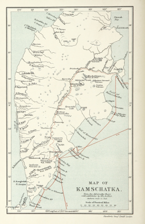
kamchatka oblast
old maps of saint-louis (senegal)
orientalist painting
maps of liège by johannes blaeu - derivative files
cathédrale notre-dame-et-saint-lambert (liège)
maps of paris from paris musées
baroque
bird's eye view of knoxville, tennessee, 1886
maps in the library of congress
19th-century maps of maastricht
maps in hcl (maastricht)
eran laor cartographic collection
tranquillo mollo
19th-century maps of the malay archipelago
19th-century maps of southeast asia
maps of roanoke island
theodor de bry
media from regionaal archief alkmaar
oudkarspel
eran laor cartographic collection
joseph schwarz
eran laor cartographic collection
raymond bonheur
gemeente atlas van nederland - south holland
maps of alkemade
science
maps
illustration
maps
siberia and the exile system (1891)
19th-century maps of siberia
van langren map of southeast asia
renaissance
siberia and the exile system (1891)
19th-century maps of siberia
a new map of the island of tobago... - by tho.s kitchin... - btv1b53121990k
maps by thomas kitchin
18th-century maps of corsica
maps by thomas kitchin
a new map of the island of tobago... - by tho.s kitchin... - btv1b53121990k
maps by thomas kitchin
print room of the university of antwerp
18th-century maps of antwerp
eran laor cartographic collection
nicolas langlois
eran laor cartographic collection
joan blaeu
media contributed by university of illinois urbana-champaign university library
carte de barbarie, nigritie, guinée par guillaume delisle (1707)
maps by jodocus hondius
old maps of nassau
maps of the spanish-american war
1890s maps of the philippines
maps from the earth and its inhabitants, vol. ix
maps of herat
maps from the earth and its inhabitants, vol. vii
maps of lhasa
maps from the earth and its inhabitants, vol. xi
maps of benghazi
maps from the earth and its inhabitants, vol. xvi
maps of mexico
print room of the university of antwerp
kaarten van vlaanderen (prentenkabinet)
maps of the byzantine levant
1650s maps showing history
guillaume-nicolas delahaye
jacques martin
history of weißenfels
baroque
media from the national library of finland
classicism
maps from the earth and its inhabitants, vol. xiii
africa in the 1890s
maps from the earth and its inhabitants, vol. xi
africa in the 1890s
maps from the earth and its inhabitants, vol. xiii
africa in the 1890s
maps from the earth and its inhabitants, vol. xiii
africa in the 1890s
maps from the earth and its inhabitants, vol. xii
africa in the 1890s
maps from the earth and its inhabitants, vol. xi
africa in the 1890s
maps from the earth and its inhabitants, vol. xii
africa in the 1890s
maps from the earth and its inhabitants, vol. xiii
africa in the 1890s
maps from the earth and its inhabitants, vol. xiii
africa in the 1890s
maps from the earth and its inhabitants, vol. xiii
maps of africa
maps from the earth and its inhabitants, vol. xii
africa in the 1890s
maps from the earth and its inhabitants, vol. xiii
africa in the 1890s
maps from the earth and its inhabitants, vol. xi
africa in the 1890s
maps from the earth and its inhabitants, vol. xi
africa in the 1890s
maps from the earth and its inhabitants, vol. xii
africa in the 1890s
maps from the earth and its inhabitants, vol. xiii
africa in the 1890s
maps from the earth and its inhabitants, vol. xiii
africa in the 1890s
maps from the earth and its inhabitants, vol. xiii
maps of africa
maps from the earth and its inhabitants, vol. xii
africa in the 1890s
maps from the earth and its inhabitants, vol. xii
africa in the 1890s
maps by willem and johannes blaeu
maps of the wadden sea
maps from the earth and its inhabitants, vol. xii
africa in the 1890s
maps from the earth and its inhabitants, vol. xiii
maps of africa
maps from the earth and its inhabitants, vol. xi
africa in the 1890s
maps from the earth and its inhabitants, vol. xii
africa in the 1890s
maps from the earth and its inhabitants, vol. xii
africa in the 1890s
africa in the 1890s
maps of africa
africa in the 1890s
maps of africa
old maps of the dutch gold coast
willem cornelis van baarsel
17901 - 18000 of 38,646
Next page
/ 387