En
Log in
All resources
Create a design
Tools
38,646 Free Artworks of Map
bibliothèque nationale de france
maps from university of amsterdam special collections
atlas der neederlanden
copperplate print
special collections of the university of amsterdam
maps from the earth and its inhabitants, vol. x
africa in the 1890s
maps of africa
maps from the earth and its inhabitants, vol. xiii
maps from the earth and its inhabitants, vol. xi
everett d. graff collection of western americana
maps of the united states
chorographia britanniae (1741-1742)
18th-century maps of cornwall
chorographia britanniae (1741-1742)
18th-century maps of kent
eran laor cartographic collection
joseph roux
eran laor cartographic collection
jaspar isaac
hamburg in topographia saxoniae inferioris (merian)
baroque
turgot map of paris, david rumsey historical map collection – derivative files
collège des quatre-nations
maps from the earth and its inhabitants, vol. x
19th-century maps of africa
maps of bamberg by braun & hogenberg
st. gangolf (bamberg)
maps from the earth and its inhabitants, vol. x
19th-century maps of africa
maps from the earth and its inhabitants, vol. x
19th-century maps of africa
maps from géographie illustrée de la france et de ses colonies
19th-century maps of calvados
maps from university of amsterdam special collections
atlas der neederlanden
maps from university of amsterdam special collections
atlas der neederlanden
maps from university of amsterdam special collections
atlas der neederlanden
maps of the americas by michael mercator
ateliers bmb mercator
maps of england by gerardus mercator
ateliers bmb mercator
maps of europe by mercator-hondius
ateliers bmb mercator
mercator 1587 world map
ateliers bmb mercator
maps of asia by mercator-hondius
ateliers bmb mercator
media from regionaal archief alkmaar
egmond-binnen
plan de roussel - derivative files
maps of montrouge
maps from the earth and its inhabitants, vol. xii
africa in the 1890s
maps of augsburg by braun & hogenberg
eran laor cartographic collection
maps from the earth and its inhabitants, vol. xiii
africa in the 1890s
maps from the earth and its inhabitants, vol. xiii
africa in the 1890s
maps from the earth and its inhabitants, vol. xii
africa in the 1890s
maps from the earth and its inhabitants, vol. xii
africa in the 1890s
maps from the earth and its inhabitants, vol. xiii
africa in the 1890s
maps of cologne by braun & hogenberg
eran laor cartographic collection
17th-century maps of maastricht
siege of maastricht (1632)
dripps maps of manhattan published in 1867
neoclassicism
van langren map of southeast asia
1599 maps of asia
maps of paris from bibliothèque nationale de france
map of paris by claes jansz. visscher
maps by willem and johannes blaeu
1635 maps
hamburgische elbkarte von melchior lorichs
parts of old maps of hamburg
algeria in the 1880s
old maps of algeria
turgot map of paris, norman b. leventhal map center – derivative files
rue de braque on maps
media from accademia delle scienze di torino
1574 illustrations
maps from university of amsterdam special collections
atlas der neederlanden
our arctic province, alaska and the seal islands (1886)
old maps of alaska
cartes de franz schrader
old maps of the alps
topographisch-historische ansicht der belagerung kopenhagens (1807)
maps from the mechanical curator collection
transpadana venetorum ditio (galleria delle carte geografiche)
old maps of the province of bergamo
maps of cambridge by braun & hogenberg
1575 maps of england
17th-century maps of the mediterranean sea
portolan charts made in the 17th century
jean-baptiste-henri delahaye
philippe buache
maps from the earth and its inhabitants, vol. xi
africa in the 1890s
maps by alain manesson-mallet
history of galle fort
gemeente atlas van nederland - north holland
bennebroek
chicago and the midwest, newberry library
rand mcnally
maps from the earth and its inhabitants, vol. xi
old maps of oran province
maps from the earth and its inhabitants, vol. x
1890 maps of egypt
le antichità romane (piranesi)
neoclassicism
maps of rotterdam by braun & hogenberg
maps of delft by braun & hogenberg
anteckning om krigshändelserna i kurland
maps of the great northern war
maps of milan by braun & hogenberg
baroque
maps of bourgogne (duchy) by gerardus mercator
1630s maps of france
maps from university of amsterdam special collections
atlas der neederlanden
maps from university of amsterdam special collections
atlas der neederlanden
maps from university of amsterdam special collections
atlas der neederlanden
maps from university of amsterdam special collections
atlas der neederlanden
maps from university of amsterdam special collections
atlas der neederlanden
map of amsterdam by gerrit de broen (ii)
maps in the stadsarchief amsterdam
maps of abyssinia by mercator-hondius
gemeente atlas van nederland - north holland
maps of broek in waterland
the loyal west in the times of the rebellion (ohio)
maps of the cuyahoga river
maps from the earth and its inhabitants, vol. xi
africa in the 1890s
maps from the earth and its inhabitants, vol. x
pyramids of meroe
maps from the earth and its inhabitants, vol. x
1890 maps of egypt
chicago and the midwest, newberry library
rand mcnally
maps of edinburgh by braun & hogenberg
18th-century maps of scotland
maps by isaak tirion
1753 maps
maps from the earth and its inhabitants, vol. xiii
maps of journeys
maps from the earth and its inhabitants, vol. vi
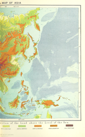
topographic maps of asia
maps from the earth and its inhabitants, vol. iv
cirencester
maps from the earth and its inhabitants, vol. xiii
19th-century maps of madagascar
maps from the earth and its inhabitants, vol. iv
19th-century double hemisphere world maps
maps from the earth and its inhabitants, vol. xvi
19th-century maps of mexico city
maps from the earth and its inhabitants, vol. xvi
19th-century maps of jamaica
maps from the earth and its inhabitants, vol. iv
charts of plymouth sound
maps from the earth and its inhabitants, vol. xvii
linguistic maps of north america
maps of the districts of the canton of bern
biel/bienne (administrative district)
maps from the earth and its inhabitants, vol. xi
oases of libya
maps from the earth and its inhabitants, vol. xi
roads in tunisia
maps from the earth and its inhabitants, vol. iv
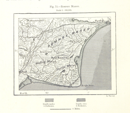
romney marsh
maps from the earth and its inhabitants, vol. xiii
old maps of luanda
maps from the earth and its inhabitants, vol. v
ringkjøbing
maps from the earth and its inhabitants, vol. xiv
exploration of australia
maps from the earth and its inhabitants, vol. xviii
south america in the 19th century
1860s maps of georgia (u.s. state)
maps in the library of congress
17th-century maps of the strait of magellan
maps by jodocus hondius
atlas vingboons
1665
old maps of north holland
zaandam
media from regionaal archief alkmaar
sint pancras
maps from the earth and its inhabitants, vol. xi
maps indicating exploration
maps of rivers of south sudan
sobat river
maps from the earth and its inhabitants, vol. x
khedivate of egypt
maps from the earth and its inhabitants, vol. v
maps of the north atlantic
maps from the earth and its inhabitants, vol. iv
sewers in london
17401 - 17500 of 38,646
Next page
/ 387