En
Log in
All resources
Create a design
Tools
38,646 Free Artworks of Map
gemeente atlas van nederland - north holland
1860s maps of north holland
africa in the 1890s
maps of africa
maps from the earth and its inhabitants, vol. xiii
maps from the earth and its inhabitants, vol. xi
bibliothèque nationale de france
eran laor cartographic collection
latin-language maps
media from regionaal archief alkmaar
maps of groningen by braun & hogenberg
eran laor cartographic collection
maps of aachen by braun & hogenberg
city walls of aachen
media from regionaal archief alkmaar
oterleek
media from regionaal archief alkmaar
schermerhorn
cartes de franz schrader
1894 maps of france
jan karel donatus van beecq
hernán cortés
schwägrichens garten
adolf eltzner
maps by pieter mortier
old maps of rovigo
maps of bouchain city walls
old maps of bouchain
illustrations from the mysterious island by jules férat
maps of the mysterious island
maps of liège by johannes blaeu - derivative files
abbaye du val des écoliers de liège
european art in the art institute of chicago
maps of south america by mercator-hondius
maps of aachen by braun & hogenberg
city walls of aachen
topographischer atlas der schweiz
old maps of zürich
châlons-en-champagne in the 17th century
hugues picart
hôtel de guénégaud (quai de nevers)
collège des quatre-nations
map of maastricht by willem and johannes blaeu (1649)
jekerkwartier (maastricht)
bibliothèque municipale de reims, rès. g 153
baroque
perris maps of manhattan published 1852–1853
neoclassicism
maps from the earth and its inhabitants, vol. xii
africa in the 1890s
maps from the earth and its inhabitants, vol. xiii
africa in the 1890s
maps from the earth and its inhabitants, vol. xiii
maps of africa
gemeente atlas van nederland - north holland
maps of obdam
maps from the earth and its inhabitants, vol. xi
africa in the 1890s
gemeente atlas van nederland - north holland
maps of hoogwoud
gemeente atlas van nederland - north holland
maps of middelie
maps from the earth and its inhabitants, vol. xi
africa in the 1890s
maps of the battle of perryville
memoirs of henry villard
gemeente atlas van nederland - north holland
maps of schellinkhout
gemeente atlas van nederland - north holland
maps of spanbroek
gemeente atlas van nederland - north holland
maps of landsmeer
maps from the earth and its inhabitants, vol. xi
africa in the 1890s
maps from the earth and its inhabitants, vol. xiii
africa in the 1890s
gemeente atlas van nederland - north holland
maps of katwoude
gemeente atlas van nederland - north holland
maps of wijdenes
gemeente atlas van nederland - north holland
maps of wormerveer
gemeente atlas van nederland - north holland
maps of oudendijk
gemeente atlas van nederland - north holland
maps of wormer
gemeente atlas van nederland - north holland
maps of oosthuizen
gemeente atlas van nederland - north holland
maps of uitgeest
maps from the earth and its inhabitants, vol. xi
africa in the 1890s
voyages and travels to india, ceylon, the red sea, abyssinia, and egypt, vol. 3
henry cooper (engraver)
adventure films
action films
bibliothèque nationale de france
fra mauro map derivative works
eran laor cartographic collection
joan blaeu
eran laor cartographic collection
étienne dupérac
tourism advertising posters of germany
1935 maps of germany
asia noviter delineata
1617 drawings
maps of haarlemmerhout
old maps of haarlem
the columbian magazine (1789)
pre-raphaelite brotherhood
maps made in the 17th century
lazio
maps by jan janssonius
atlas novus (blaeu)
gemeente atlas van nederland - north holland
maps of krommenie
gemeente atlas van nederland - north holland
maps of opmeer
topographia bohemiae moraviae et silesiae (merian)
baroque
gemeente atlas van nederland - north holland
maps of midwoud
maps by giacomo gastaldi
cornelis de jode
maps from the earth and its inhabitants, vol. xiii
africa in the 1890s
maps from the earth and its inhabitants, vol. xiii
maps of africa
gemeente atlas van nederland - north holland
maps of twisk
gemeente atlas van nederland - north holland
maps of avenhorn
gemeente atlas van nederland - north holland
maps of wieringerwaard
gemeente atlas van nederland - north holland
maps of wijdewormer
old maps of westland
old maps of delfland
gemeente atlas van nederland - north holland
maps of hoogkarspel
maps from the earth and its inhabitants, vol. xi
africa in the 1890s
maps from the earth and its inhabitants, vol. xii
africa in the 1890s
gemeente atlas van nederland - north holland
maps of zwaag
16th-century maps of istanbul
david kandel
topographia bohemiae moraviae et silesiae (merian)
baroque
gemeente atlas van nederland - north holland
maps of sijbekarspel
gemeente atlas van nederland - north holland
maps of urk
john rocque's 1748 map of london and adjacent country
maps in the british museum
baroque frescos in catania
1669 maps
old maps of asturias
1777 maps of spain
old maps of asturias
1777 maps of spain
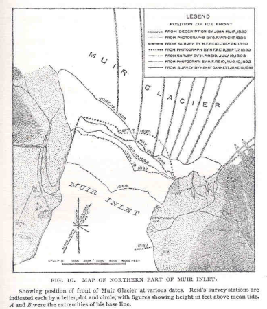
glaciers and glaciation (1910)
maps of muir glacier
1807 maps of south america
maps by john cary
maps from university of amsterdam special collections
atlas der neederlanden
terrae sanctae tabula by guillaume delisle (1763)
eran laor cartographic collection
geographia universalis (1545) in the british museum
german renaissance,northern renaissance
maps by willem and johannes blaeu
17th-century maps of sumatra
synopsis universae philologiae
1741 maps of asia
maps of liège by johannes blaeu - derivative files
map of amsterdam, 1544
cornelis anthonisz.
maps by wilhelm maximilian carpelan
kvarnvikens kvarn
maps by wilhelm maximilian carpelan
maps of lidingö
sicilia (galleria delle carte geografiche)
old maps of syracuse
chicago and the midwest, newberry library
1931 maps
maps by willem and johannes blaeu
maps of gelderland
media from regionaal archief alkmaar
limmen
old maps of hispaniola
ambroise tardieu
algiers in the 1880s
old maps of algiers
media from regionaal archief alkmaar
schoorl
cartography
maps
maps of asia by gerardus mercator
ateliers bmb mercator
17th-century maps of the indian ocean
maps by willem and johannes blaeu
maps by willem and johannes blaeu
old maps of aardenburg
gerardi mercatoris atlantis novi. pars tetria (1638)
17th-century maps of lombardy
the war between the united states and mexico illustrated
maps of the mexican-american war
16801 - 16900 of 38,646
Next page
/ 387