En
Log in
All resources
Create a design
Tools
38,646 Free Artworks of Map
description de l'universe
alain manesson mallet
bibliothèque nationale de france
beschreibung und contrafactur der vornembster stät der welt, liber primus civitates orbis terrarum
1685 maps of europe
maps by willem and johannes blaeu
17th-century maps of italy
tresor des cartes geographiques (1659)
charles eugène perron
1876 maps
17th-century maps of bavaria
description de l'universe
17th-century maps of france
description de l'universe
description de l'universe
1685 maps of the bahamas
description de l'universe
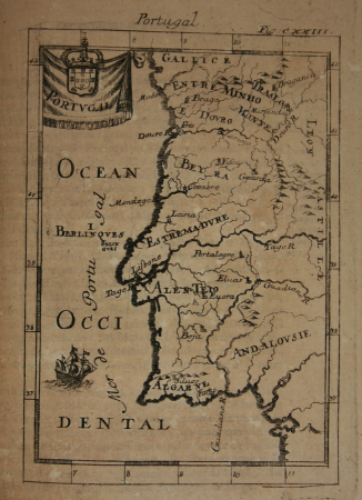
1680s maps of portugal
1800s maps of denmark
1801 maps of europe
grosser deutscher atlas
old maps of switzerland
copper engravings
1619 engravings
high renaissance
codex windsor
maps of adelaide
william light
maps from the earth and its inhabitants, vol. xv
maps of native american tribal territories
map of paris by braun & hogenberg - derivative files
porte papale
maps by willem and johannes blaeu
siege of groenlo 1627
untrodden peaks and unfrequented valleys (1873)
maps of south tyrol
maps by william home lizars
old maps of sydney
history of whitby, north yorkshire
british library maps collections
maps by willem and johannes blaeu
1635 maps
palatinatus rheni (merian)
baroque
old maps of north rhine-westphalia
baroque
maps of goa by linschoten
portuguese india
description de l'universe
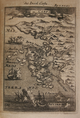
1680s maps of cyprus
description de l'universe
old maps of french guiana
description de l'universe
17th-century maps of cuba
description de l'universe
old maps of lemnos
description de l'universe
old maps of scotland
description de l'universe
1685 maps of europe
17th-century maps of italy
description de l'universe
17th-century maps of france
description de l'universe
17th-century maps of italy
description de l'universe
1685 maps of the caribbean
description de l'universe
description de l'universe
old maps of north america
old maps of the united states
description de l'universe
map of the circle of the rhineland by sanson
1730s maps of rhineland-palatinate
1750s maps of central america
maps by tomas lopez
1572 maps of africa
1570s maps of egypt
carte de la mer mediterranée (1764) by roux
eran laor cartographic collection
maps in the library of congress
old maps of connecticut
maps of frankfurt-innenstadt
maps of frankfurt-nordend
guillaume sanson
maps of meaux
considérations géographiques et physiques sur les nouvelles découvertes au nord de la grande mer
isla de los estados
beschreibung und contrafactur der vornembster stät der welt, liber primus civitates orbis terrarum
maps of 's-hertogenbosch by braun & hogenberg
beschreibung und contrafactur der vornembster stät der welt, liber primus civitates orbis terrarum
maps of kozhikode by braun & hogenberg
beschreibung und contrafactur der vornembster stät der welt, liber primus civitates orbis terrarum
maps of málaga by braun & hogenberg
old maps of washington, d.c.
pre-raphaelite brotherhood
glaciers and glaciation (1910)
maps of glaciers of alaska
map of the circle of the rhineland by sanson
1700s maps of rhineland-palatinate
1750s maps of central america
maps by tomas lopez
daniel de la feuille
1706 maps of italy
german renaissance,humanism
old maps of cairo
elbe in brunsbüttel
brunsbüttel
civitates orbis terrarum. urbium praecipuarum totius mundi. liber quartus
maps of harlingen by braun & hogenberg
maps of kodagu district
edward weller
german renaissance
old maps of venice
gemeente atlas van nederland - north holland
old maps of beverwijk
civitates orbis terrarum. urbium praecipuarum totius mundi. liber quartus
maps of sloten by braun & hogenberg
a & c black general atlas of the world
1850s maps of the world
atlas des anciens plans de paris by imprimerie nationale, 1880 from the musée carnavalet
maps of paris from paris musées
tresor des cartes geographiques (1659)
old maps of tunis
beschreibung und contrafactur der vornembster stät der welt, liber primus civitates orbis terrarum
maps of wesel by braun & hogenberg
beschreibung und contrafactur der vornembster stät der welt, liber primus civitates orbis terrarum
maps of lindau (bodensee) by braun & hogenberg
beschreibung und contrafactur der vornembster stät der welt, liber primus civitates orbis terrarum
maps of safi by braun & hogenberg
tresor des cartes geographiques (1659)
1650s maps of the tsardom of russia
beschreibung und contrafactur der vornembster stät der welt, liber primus civitates orbis terrarum
maps of weimar by braun & hogenberg
hamburgische elbkarte von melchior lorichs
parts of old maps of hamburg
tresor des cartes geographiques (1659)
1650s maps of the world
old maps of ostend
siege of ostend
nouvelle géographie universelle, vol. xii
charles eugène perron
media from regionaal archief alkmaar
oudkarspel
maps in the library of congress
1861 maps of virginia
arnold van langren map of southwest africa
renaissance
maps of lindau (bodensee) by braun & hogenberg
lake constance in bavaria in art
maps of the principality of lüneburg
atlas novus (blaeu)
maps by willem and johannes blaeu
1662 maps of norway
maps of 's-hertogenbosch by braun & hogenberg
maps by willem and johannes blaeu
maps of brussels city walls
old maps of brussels
old administrative maps of the ottoman empire
1909 maps of asia
considérations géographiques et physiques sur les nouvelles découvertes au nord de la grande mer
hokkaido in art
maps by hendrik hondius the younger
maps from gallica
turgot map of paris, kyoto university library – derivative files
plans of the musée rodin
17th-century maps of scandinavia
description de l'universe
prints in the stadsarchief amsterdam
map of amsterdam, 1544
maps from the earth and its inhabitants, vol. x
1890 maps of africa
map of paris by jouvin de rochefort (boutier 112)
pont de grammont
maps of the course of the rhine by guillaume sanson
guillaume sanson
dheulland map of paris
map collection of leibniz-institut für länderkunde
dheulland map of paris
map collection of leibniz-institut für länderkunde
dheulland map of paris
nouvelle géographie universelle, vol. xii
charles eugène perron
africa and its inhabitants, vol. ii
charles eugène perron
maps from university of amsterdam special collections
atlas der neederlanden
maps from university of amsterdam special collections
atlas der neederlanden
maps of kingdom of westphalia
1808 in germany
1870s maps of the caucasus
g. h. swanston
atlas minor gerardi mercatoris (1621, maps)
maps of china by mercator-hondius
description de l'universe
1685 maps of europe
description de l'universe
1680s maps of germany
description de l'universe
1685 maps of europe
17th-century maps of guyana
description de l'universe
description de l'universe
1685 maps of europe
description de l'universe
1680s maps of germany
17th-century maps of italy
description de l'universe
15801 - 15900 of 38,646
Next page
/ 387