En
Log in
All resources
Create a design
Tools
38,646 Free Artworks of Map
joan blaeu
copper engraving print
british library
atlas maior, vol 5 (england) - joan blaeu, 1667 - bl 114.h(star).5
bibliothèque nationale de france
eran laor cartographic collection
french-language maps
maps of spain by tomas lopez
maps by willem and johannes blaeu
1858 van de velde maps of palestine and jerusalem
maps from the earth and its inhabitants, vol. xii
maps of icebergs
maps from the earth and its inhabitants, vol. viii
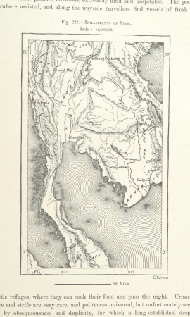
demographic maps of thailand
maps from the earth and its inhabitants, vol. xiii
ethnographic maps of africa
eran laor cartographic collection
elias baeck
nouvelle géographie universelle, vol. xii
1890s maps of africa
maps of spain by tomas lopez
1779 maps of spain
old maps of tenerife
1779 maps of spain
maps of spain by tomas lopez
1773 maps of spain
maps in the british museum
1780s maps of france
maps of the west-indische compagnie
1668
maps in the library of congress
civitates orbis terrarvm
peregrinatio in terram sanctam (reuwich, 1486, latin)
1486 illustrations
maps in the british museum
maps by john speed
1610s maps of the holy roman empire
jacques surhon
old geological maps by jean-etienne guettard
jean étienne guettard
illustrations by true williams
roughing it (1872)
drawings in the museu antônio parreiras
paper and graphite
drawings in the museu antônio parreiras
paper and graphite
maps of paris from paris musées
baroque
drawings in the museu antônio parreiras
paper and graphite
historical maps of the county of kłodzko
coats of arms of county of kladsko
eran laor cartographic collection
romeyn de hooghe
cornelius aurelius world map
ptolemaic taprobana
1620s maps of the iberian peninsula
maps by willem and johannes blaeu
nouvelle géographie universelle, vol. xii
charles eugène perron
map of expo 1913
expo 1913
nouvelle géographie universelle, vol. xii
charles eugène perron
maps in the library of congress
1758 maps of cuba
maps of castile by mercator-hondius
18th-century maps of north africa
maps by tomas lopez
maps of spain by tomas lopez
1779 maps of spain
maps of spain by tomas lopez
1779 maps of spain
maps of spain by tomas lopez
1773 maps of spain
eran laor cartographic collection
joseph goupy
eran laor cartographic collection
afbeeldinge der stad jerusalem
eran laor cartographic collection
joseph goupy
eran laor cartographic collection
joseph goupy
maps of landgraaf
rimburg
gloucester, massachusetts, in the 19th century
massachusetts in the 1850s
maps from the earth and its inhabitants, vol. xii
canary islands in the 1890s
maps by willem and johannes blaeu
old maps of wageningen
1858 van de velde maps of palestine and jerusalem
1858 van de velde maps of palestine and jerusalem
maps by willem and johannes blaeu
old maps of alkmaar
maps by willem and johannes blaeu
old maps of dokkum
maps by willem and johannes blaeu
old maps of enkhuizen
maps in the library of congress
1889 maps of new york (state)
arnold van langren map of southwest africa
1600 maps of africa
maps by johannes vingboons
old maps of asia
1858 van de velde maps of palestine and jerusalem
1858 van de velde maps of palestine and jerusalem
1858 van de velde maps of palestine and jerusalem
map of paris by braun & hogenberg - derivative files
rue des archives (paris)
17th-century maps of paris
baroque
maps by john cary
1799 maps
david rumsey historical map collection
1790s maps of the holy roman empire
nouvel atlas de la chine
claas condet
old maps of montana
julius bien
eran laor cartographic collection
rémy hausermann
plans of central cemetery in sanok
maps of sanok
maps of bremen by braun & hogenberg
maps of mitte (bremen)
old maps of westphalia
bindenschild
gemeente atlas van nederland - south holland
1860s maps of south holland
aftermath of world war ii
1945 maps of the world
maps from the earth and its inhabitants, vol. xiii
africa in the 1890s
17th-century maps of transylvania
coats of arms on maps
1696 maps of the caribbean
1690s maps of mexico
maps of aire-sur-la-lys city walls
old maps of aire-sur-la-lys
sanborn maps of manhattan published in 1904
irt sixth avenue line stations
maps of the malay archipelago by mercator-hondius
beschreibung der städt der welt - braun & hogenberg - btv1b52512111k
maps of münster (westfalen) by braun & hogenberg
beschreibung der städt der welt - braun & hogenberg - btv1b52512111k
maps of tunis by braun & hogenberg
maps from the mechanical curator collection available to georeference
maps from the mechanical curator collection
beschreibung und contrafactur der vornembster stät der welt, liber primus civitates orbis terrarum
panoramic maps of seville by braun & hogenberg
old and new london, illustrated (1873) by walter thornbury and edward walford - bl 1887 copy
maps from the mechanical curator collection
gemeente atlas van nederland - north holland
old maps of heemstede, north holland
maps by jacques-nicolas bellin
maps of goa by linschoten
curt teich postcard archives
map postcards
turgot map of paris, david rumsey historical map collection – derivative files
île louviers
maps from the earth and its inhabitants, vol. xv
exploration of the arctic
maps of chimay by braun & hogenberg
maps of chimay city walls
atlas maior, vol 5 (england) - joan blaeu, 1667 - bl 114.h(star).5
17th-century maps of northamptonshire
atlas maior, vol 5 (england) - joan blaeu, 1667 - bl 114.h(star).5
17th-century maps of middlesex
atlas maior, vol 5 (england) - joan blaeu, 1667 - bl 114.h(star).5
17th-century maps of northumberland
atlas maior, vol 5 (england) - joan blaeu, 1667 - bl 114.h(star).5
17th-century maps of shropshire
atlas maior, vol 5 (england) - joan blaeu, 1667 - bl 114.h(star).5
17th-century maps of monmouthshire
atlas maior, vol 6 (scotland and ireland) - joan blaeu, 1667 - bl 114.h(star).6
1667 maps
atlas maior, vol 5 (england) - joan blaeu, 1667 - bl 114.h(star).5
17th-century maps of radnorshire
atlas maior, vol 12 (america) - joan blaeu, 1667 - bl 114.h(star).12
1667 maps
atlas maior, vol 5 (england) - joan blaeu, 1667 - bl 114.h(star).5
17th-century maps of cambridgeshire
atlas maior, vol 5 (england) - joan blaeu, 1667 - bl 114.h(star).5
17th-century maps of staffordshire
atlas maior, vol 1 (northern europe, norway, and denmark) - joan blaeu, 1667 - bl 114.h(star).1
1667 maps
atlas maior, vol 5 (england) - joan blaeu, 1667 - bl 114.h(star).5
17th-century maps of oxfordshire
atlas maior, vol 5 (england) - joan blaeu, 1667 - bl 114.h(star).5
17th-century maps of somerset
atlas maior, vol 9 (italy) - joan blaeu, 1667 - bl 114.h(star).9
1667 maps of italy
atlas maior, vol 5 (england) - joan blaeu, 1667 - bl 114.h(star).5
17th-century maps of rutland
atlas maior, vol 5 (england) - joan blaeu, 1667 - bl 114.h(star).5
17th-century maps of lincolnshire
atlas maior, vol 5 (england) - joan blaeu, 1667 - bl 114.h(star).5
17th-century maps of herefordshire
atlas maior, vol 5 (england) - joan blaeu, 1667 - bl 114.h(star).5
17th-century maps of derbyshire
atlas maior, vol 12 (america) - joan blaeu, 1667 - bl 114.h(star).12
1667 maps
15201 - 15300 of 38,646
Next page
/ 387