En
Log in
All resources
Create a design
Tools
38,646 Free Artworks of Map
bibliothèque nationale de france
maps in the library of congress
gemeente atlas van nederland - south holland
1860s maps of south holland
baroque
eran laor cartographic collection
atlas van loon
maps from the earth and its inhabitants, vol. x
maps by willem and johannes blaeu
maps from university of amsterdam special collections
maps from university of amsterdam special collections
atlas der neederlanden
carte de moscovie by guillaume de l'isle (1706)
eran laor cartographic collection
maps from kiesslings wanderbuch für die mark brandenburg
1898 in berlin
maps of paris from the david rumsey historical map collection
1778 in paris
joseon dynasty
heo mok
old maps of coevorden
atlas van loon
siege of steenwijk 1592
maps of steenwijk
1600s maps of bremen (state)
17th-century maps of bremen
1780s maps of the balkans
maps by tomas lopez
gemeente atlas van nederland - south holland
maps of stompwijk
gemeente atlas van nederland - north holland
maps of beemster
maps of paris by braun & hogenberg
maps of paris from paris musées
maps of valenciennes city walls
old maps of valenciennes
maps in the library of congress
1769 maps of europe
maps of the ottoman empire by mercator-hondius
map
maps from the earth and its inhabitants, vol. x
maps of damietta
gemeente atlas van nederland - south holland
maps of lisse
historisk atlas (stockholm, norstedt & söner, 1880)
maps of 13th-century greece
carte de la mer mediterranée (1764) by roux
eran laor cartographic collection
1710s maps of eastern europe
muscovy
former theatres in boston
boston in the 1910s
18th-century maps of edinburgh-shire
maps of scotland by herman moll
maps of the dutch east india company - indonesia
18th-century maps of java
19th-century maps of dresden
johanniskirche (dresden)
miniature speed atlas (1627) pieter van den keere
old county maps of lancashire
miniature speed atlas (1627) pieter van den keere
1620s maps of wales
old maps of freiburg im breisgau
emery walker
maps by gerard de jode
1593 maps of africa
maps from university of amsterdam special collections
atlas der neederlanden
maps of paris from the open data hauts-de-seine
1710s maps of paris
maps of sterrenburg (utrecht)
atlas van loon
media from the national library of finland
classicism
maps by gerardus mercator
kempen (region)
maps in the library of congress
1852 maps of massachusetts
maps in the library of congress
1830s maps of china
18th-century maps of veneto
1700s maps of slovenia
maps from gallica
old maps of psarà
john rocque 1746 crops from library of congress
john rocque
maps in the library of congress
1771 maps of north america
engravings of topographia braunschweig lüneburg
baroque
18th-century maps of the indian ocean
bodleian maps collection
map of bruges by marcus gheeraerts (i)
drawings in the groeningemuseum
maps of the ural mountains
russia (1913)
maps of brest from bibliothèque nationale de france
brest (france) in the 1700s
1830 maps of the united states
maps by george w. boynton
old maps of north rhine-westphalia
maps of balve
1780s maps of the caribbean
maps in the british museum
18th-century maps of the canary islands
maps of spain by tomas lopez
topographia westphaliae (merian)
baroque
gemeente atlas van nederland - drenthe
drenthe
1739 maps of france
plan de turgot
map of paris by braun & hogenberg - derivative files
rue des archives (paris)
maps by willem and johannes blaeu
1630s maps of the caucasus
maps by matthäus merian
baroque
west seram regency
johannes nessel
maps from the earth and its inhabitants, vol. xiii
africa in the 1890s
gemeente atlas van nederland - south holland
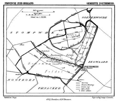
maps of zoetermeer
curt teich postcard archives
map postcards
maps of the province of ávila
1769 maps of spain
broomfields, bradford
robert dawson
18th-century maps of antarctica
1741 maps
old maps of samegrelo
cornelis de jode
palau in the 18th century
old maps of palau
cartes de franz schrader
maps of algeria by theme
media from regionaal archief alkmaar
maps of barsingerhorn
maps of linden (hannover)
lindener berg (hannover)
guide joanne normandie-1912
1912 maps of france
1942 watercolor paintings
works by eric ravilious
map of bruges by marcus gheeraerts (i)
sint-gilliskwartier
hamburgische elbkarte von melchior lorichs
parts of old maps of hamburg
17th-century maps of the iberian peninsula
description de l'universe
turgot map of paris, kyoto university library – derivative files
collège du plessis
print room of the university of antwerp
citadel van antwerpen
maps in the library of congress
1713 maps
maps of the duchy of berg
maps by gerard valck
maps by willem and johannes blaeu
maps of montfoort
maps from the earth and its inhabitants, vol. x
1890 maps of africa
20th-century maps of battles
battle of mondovi
maps from the earth and its inhabitants, vol. xii
africa in the 1890s
maps from the earth and its inhabitants, vol. vi
1891 maps of georgia
gemeente atlas van nederland - south holland
maps of groot-ammers
maps of paris by braun & hogenberg
maps of paris from paris musées
maps in the staats- und universitätsbibliothek hamburg
1841 maps of hamburg
old maps of japan
kimura kenkado
the comprehensive history of england (1876)
english-language maps showing history
english-language maps of africa
maps by emanuel bowen
maps from the earth and its inhabitants, vol. x
19th-century maps of africa
old maps of virginia
p.s. duval & son
german renaissance,northern renaissance
1500 maps
nicolaas samuel crucquius
old maps of delfland
eran laor cartographic collection
william henry toms
situs terrae promissionis by christian van adrichom
christian van adrichem
siege of győr (1598) in art
1602 books
old maps of hindeloopen
baroque
maps of mombasa by braun & hogenberg
maps of cefala by braun & hogenberg
18th-century maps of antwerp
anna beeck
nypl collection of atlases, gazetteers, guidebooks and other books
nypl lionel pincus and princess firyal map division
university of amsterdam
map of amsterdam, 1544
lordship of mechelen
1645 maps of belgium
truscott map of st-petersburg 1753
ivan sokolov
14601 - 14700 of 38,646
Next page
/ 387