En
Log in
All resources
Create a design
Tools
81,839 Free Images of Subject
bibliothèque nationale de france
maps of spain by tomas lopez
de zegepraalende vecht, vertoonende verscheidene gesichten van lustplaatsen, heeren huysen en dorpen; beginnende van uitrecht en met muyden besluytende. - btv1b532126488
marco boschini
maps of the islands of greece by marco boschini (1658)
guillaume sanson
maps by pieter van der keere
1766 maps of spain
1783 maps of spain
old maps of the province of soria
map of the circle of austria by sanson
1670s maps of austria
bourbonnais in the 17th century
pierre mariette i
18th-century maps of bretagne
robert cordier (engraver)
maps of the islands of greece by marco boschini (1658)
kinaros
portrait of an actor - domenico fetti
oil on canvas
sanson maps of north america
island of california
maps by pieter van der keere
ships on maps
antoine-françois tardieu
maps from gallica
antoine-françois tardieu
maps from gallica
old maps of bordelais
maps of médoc
old submaps of paris 5e arrondissement
gaston coindre
walls of olivenza, badajoz
maps of olivenza
maps by alexis-hubert jaillot
maps by guillaume sanson
drawings of sailboats
kees van waning
history of the church of scotland
james i of england
maps of asia by jean-baptiste bourguignon d'anville
french-language maps
mythological paintings by pierre-paul prud'hon
human arms in art
drawings of ports and harbours
kees van waning
louisa boren denny
david denny
samuel hirszenberg
realism
frank leslie's scenes and portraits of the civil war (1894)
american civil war in 1861
albert bierstadt by napoleon sarony
jeffrey kraus collection
les métamorphoses du jour
symbolism
maps of spain by tomas lopez
1765 maps of spain
1770s maps of the world
1775 maps
maps of the province of ávila
maps of spain by tomas lopez
maps of spain by tomas lopez
1766 maps of spain
17th-century maps of paraguay
1668 maps of south america
maps of spain by tomas lopez
1783 maps of spain
maps of vangiones by sanson
maps by nicolas sanson
american painters of yesterday and today (1919)
tonalism
maps of the islands of greece by marco boschini (1658)
context files from gallica
1620s maps of the netherlands
maps by pieter van der keere
maps of alsace by guillaume sanson
1660s maps of alsace
maps of spain by tomas lopez
1783 maps of spain
antoine-françois tardieu
1800s maps of hispaniola
maps of spain by tomas lopez
old maps of extremadura
17th-century maps of crete
old maps of candia
1660s maps of france
maps of le mans
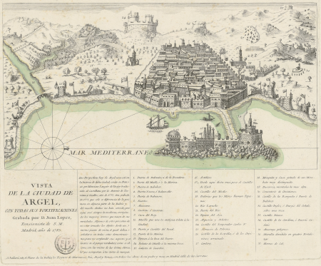
old maps of algiers
maps by juan lopez
maps of spain by tomas lopez
1766 maps of spain
1780s maps of the balkans
maps by tomas lopez
history of schwäbisch hall
baroque
1890s maps of czechia
czech-language maps
maps of spain by tomas lopez
old maps of castile and león
robert bartlett (explorer)
worn-out books
maps of spain by tomas lopez
1783 maps of spain
maps of the islands of greece by marco boschini (1658)
context files from gallica
old maps of vardø
guillaume sanson
maps of groningen by braun & hogenberg
maps of gorinchem by braun & hogenberg
maps of the islands of greece by marco boschini (1658)
old maps of skiathos
maps of spain by tomas lopez
old maps of extremadura
century magazine, 1891
madonna del cardellino
1690s maps of baden-württemberg
1690s maps of alsace
old maps of vardø
guillaume sanson
maps of spain by tomas lopez
old maps of castile and león
maps of spain by tomas lopez
old maps of castile and león
maps of spain by tomas lopez
1783 maps of spain
maps of spain by tomas lopez
old maps of castile and león
1668 maps of south america
maps by guillaume sanson
1620s maps of the netherlands
maps by pieter van der keere
maps of alsace by guillaume sanson
1690s maps of alsace
arctic expeditions from british and foreign shores - from the earliest to the expedition of 1875 (1875)
hms trent (ship, 1796)
hudson river school,impressionism,realism,realism
slavery and the slave trade in africa (1893)
families of the united states
incidental dogs
maps by willem and johannes blaeu
laurens reael
the science of eugenics and sex life, the regeneration of the human race
paintings by émile munier
1610s maps of the holy roman empire
jacques surhon
maps of the byzantine levant
1650s maps showing history
drawings by wilhelm marstrand in the statens museum for kunst
danish golden age
maps of erfurt by braun & hogenberg
maps of jena by braun & hogenberg
guillaume-nicolas delahaye
jacques martin
1891 books from the united states
art of painting
animal life in the yosemite; an account of the mammals, birds, reptiles, and amphibians in a cross-section of the sierra nevada (1924)
allan brooks
flandre espagnole et flandre hollandoise - par le sr. sanson - btv1b53042828k
guillaume sanson
carte de l'isle de ceylan by guillaume delisle (1722)
bibliothèque nationale de france
bibliothèque nationale de france
cartouches by tomas lópez
l'asie, en plusieurs cartes nouvelles, et exactes, &c. en divers traitez de geographie, et d'histoire. là où sont descrits succinctement, & avec une belle methode, & facile. ses empires, ses... - btv1b55013761m
reverse sides from gallica
maps of ports and fortresses of the mediterranean by marco boschini (1651)
bibliothèque nationale de france
de zegepraalende vecht, vertoonende verscheidene gesichten van lustplaatsen, heeren huysen en dorpen; beginnende van uitrecht en met muyden besluytende. - btv1b532126488
bibliothèque nationale de france
1650s maps of the atlantic ocean
joan blaeu
de zegepraalende vecht, vertoonende verscheidene gesichten van lustplaatsen, heeren huysen en dorpen; beginnende van uitrecht en met muyden besluytende. - btv1b532126488
bibliothèque nationale de france
carte des environs de paris (1678)
bibliothèque nationale de france
de zegepraalende vecht, vertoonende verscheidene gesichten van lustplaatsen, heeren huysen en dorpen; beginnende van uitrecht en met muyden besluytende. - btv1b532126488
bibliothèque nationale de france
de zegepraalende vecht, vertoonende verscheidene gesichten van lustplaatsen, heeren huysen en dorpen; beginnende van uitrecht en met muyden besluytende. - btv1b532126488
bibliothèque nationale de france
de zegepraalende vecht, vertoonende verscheidene gesichten van lustplaatsen, heeren huysen en dorpen; beginnende van uitrecht en met muyden besluytende. - btv1b532126488
bibliothèque nationale de france
de zegepraalende vecht, vertoonende verscheidene gesichten van lustplaatsen, heeren huysen en dorpen; beginnende van uitrecht en met muyden besluytende. - btv1b532126488
bibliothèque nationale de france
maps of ports and fortresses of the mediterranean by marco boschini (1651)
bibliothèque nationale de france
carte particulière des postes de france dediée au roy par son très humble, tres-obéssant, tres-fidele sujet et serviteur - hubert jaillot.... 20 petites lieues de france (1 - 1 800 000 environ) - btv1b8492995r
bibliothèque nationale de france
l'asie, en plusieurs cartes nouvelles, et exactes, &c. en divers traitez de geographie, et d'histoire. là où sont descrits succinctement, & avec une belle methode, & facile. ses empires, ses... - btv1b55013761m
reverse sides from gallica
maps of blâmont by braun & hogenberg
bibliothèque nationale de france
de zegepraalende vecht, vertoonende verscheidene gesichten van lustplaatsen, heeren huysen en dorpen; beginnende van uitrecht en met muyden besluytende. - btv1b532126488
bibliothèque nationale de france
topographisch, oeconomisch und militaerische charte des herzogthums mecklenburg schwerin and des fürstenthums ratzeburg - schmettau
topographisch, oeconomisch und militaerische charte von mecklenburg, schwerin und ratzeburg
l'asie, en plusieurs cartes nouvelles, et exactes, &c. en divers traitez de geographie, et d'histoire. là où sont descrits succinctement, & avec une belle methode, & facile. ses empires, ses... - btv1b55013761m
reverse sides from gallica
de zegepraalende vecht, vertoonende verscheidene gesichten van lustplaatsen, heeren huysen en dorpen; beginnende van uitrecht en met muyden besluytende. - btv1b532126488
bibliothèque nationale de france
l'asie, en plusieurs cartes nouvelles, et exactes, &c. en divers traitez de geographie, et d'histoire. là où sont descrits succinctement, & avec une belle methode, & facile. ses empires, ses... - btv1b55013761m
reverse sides from gallica
maps of the siege of cazal (1630)
baroque
maps of ports and fortresses of the mediterranean by marco boschini (1651)
bibliothèque nationale de france
archevesché d'alby. diocèse d'alby - dressé sur plusieurs memoires par le sieur sanson - btv1b531795087
guillaume sanson
de zegepraalende vecht, vertoonende verscheidene gesichten van lustplaatsen, heeren huysen en dorpen; beginnende van uitrecht en met muyden besluytende. - btv1b532126488
bibliothèque nationale de france
21101 - 21200 of 81,839
Next page
/ 819