En
Log in
All resources
Create a design
Tools
80,426 Free Images of Service
historical
forest
history
oregon
historical photo
forest service pacific northwest region
maps from the earth and its inhabitants, vol. iv
black and white
bw
region
smoke
fire
smoke
fire
swearing
usa
strawberry
greenhouse
washington
people
animals
insects
department of agriculture
usda
project 365 2009
project 365
employee
people
goldeye
usfws
emergency
officer
wildlife
nature
christmas
tree
national
forest
national
forest
christmas
tree
skull
bison
firefighter
chainsaw
landscape
snow
national
forest
nature
fish
pallid sturgeon
usfws
national
history
history
city
forest
tree
history
forest
forest
tree
history
forest
history
forest
historical
history
history
forest
vehicle
forest
history
forest
vehicle
car
history
forest
history
forest
monochrome
wood
history
forest
history
forest
fireman
fire
history
forest
landscape
forest
landscape
forest
historical
history
maps from the earth and its inhabitants, vol. xvii
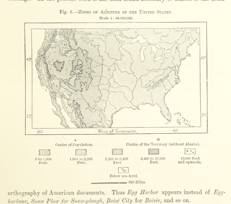
topographic maps of the united states
maps from the earth and its inhabitants, vol. iv
19th-century maps of lincolnshire
maps from the earth and its inhabitants, vol. xiii
maps of the history of south africa
maps from the earth and its inhabitants, vol. v
old maps of bornholm
maps from the earth and its inhabitants, vol. vi
atmospheric pressure maps
maps from the earth and its inhabitants, vol. xi
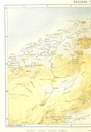
1870s maps of algeria
maps from the earth and its inhabitants, vol. x
19th-century maps of sudan
cabins in washington (state)
the pictorial history of england (george lillie craik)
maps of edinburgh by braun & hogenberg
maps from the earth and its inhabitants, vol. vi
religion maps of asia
maps from the earth and its inhabitants, vol. xvi
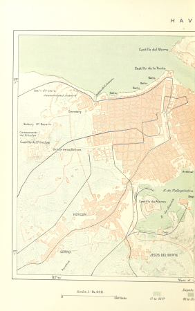
19th-century maps of havana
maps from the earth and its inhabitants, vol. xiii
maps of port elizabeth
frank leslie's scenes and portraits of the civil war (1894)
battle of fort donelson
maps from the earth and its inhabitants, vol. xii
19th-century maps of senegal
atlas geográfico y descripción geográfica y estadística de la república oriental del uruguay (1896)
maps from the earth and its inhabitants, vol. iv
old maps of reading, berkshire
maps from the earth and its inhabitants, vol. xv
maps of viking exploration
maps from the earth and its inhabitants, vol. ix
maps of the hindu kush
maps from the earth and its inhabitants, vol. x
topographic maps of africa
maps from the earth and its inhabitants, vol. xiv
saint-pierre (saint-pierre-et-miquelon)
maps from the earth and its inhabitants, vol. xvi
topographic maps of mexico
maps from the earth and its inhabitants, vol. viii
old maps of kashmir
maps from the earth and its inhabitants, vol. xvi
19th-century maps of mexico city
old maps of reaches or the estuary of the river thames
maps from the earth and its inhabitants, vol. iv
maps from the earth and its inhabitants, vol. xi
old maps of tripoli
maps from the earth and its inhabitants, vol. xviii
population density maps of south america
maps from the earth and its inhabitants, vol. v
old maps of the black sea
maps from the earth and its inhabitants, vol. xvi
19th-century maps of guadeloupe
atlas geográfico y descripción geográfica y estadística de la república oriental del uruguay (1896)
rail transport maps of uruguay
maps from the earth and its inhabitants, vol. xii
maps of the congo river
westmorland, cumberland, durham, and northumberland (1858)
old maps of westmorland
maps from the earth and its inhabitants, vol. iv
maps of the scilly islands
maps from the earth and its inhabitants, vol. vi
bathymetric maps of the caspian sea
maps from the earth and its inhabitants, vol. ix
old maps of medina
maps from the earth and its inhabitants, vol. v
population density maps of europe
maps from the earth and its inhabitants, vol. iv
19th-century maps of gloucestershire
maps from the earth and its inhabitants, vol. iii
old maps of rijeka
maps from the earth and its inhabitants, vol. iv
old maps of lindisfarne
maps from the earth and its inhabitants, vol. iv
maps of the british isles
maps from the earth and its inhabitants, vol. xv
19th-century maps of quebec
maps from the earth and its inhabitants, vol. iv
old maps of hartlepool
maps from the earth and its inhabitants, vol. iv
19th-century maps of warwickshire
maps from the earth and its inhabitants, vol. iv
19th-century maps of kent
maps from the earth and its inhabitants, vol. xviii
geology of south america
maps from the earth and its inhabitants, vol. ix
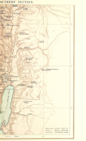
1870s maps of palestine
maps from the earth and its inhabitants, vol. xiv
maps of easter island
maps from the earth and its inhabitants, vol. xvii
19th-century maps of san francisco
maps by élisée reclus
colombia (1893)
maps from the earth and its inhabitants, vol. vii
old maps of tokyo
l'expédition du tegetthoff (1878)
maps of franz joseph land
maps from the earth and its inhabitants, vol. viii
ernst georg ravenstein
maps from the earth and its inhabitants, vol. iii
old maps of trieste
maps from the earth and its inhabitants, vol. iv
maps of the british isles
maps from the earth and its inhabitants, vol. xii
são miguel (azores)
maps from the earth and its inhabitants, vol. xvi
maps of agriculture in mexico
maps from the earth and its inhabitants, vol. iv
19th-century maps of the isle of man
37901 - 38000 of 80,426
Next page
/ 805