En
Log in
All resources
Create a design
Tools
38,380 Free Images of Atlas
gemeente atlas van nederland - north brabant
gemeente atlas van nederland - groningen
history
historical
worm
eel
university library
cnidaria
echinodermata
university of illinois urbana champaign
gemeente atlas van nederland - groningen
maps of wildervank
gemeente atlas van nederland - north brabant
oud gastel
gemeente atlas van nederland - north brabant
maps of zevenbergen
gemeente atlas van nederland - overijssel
maps of ijsselmuiden
gemeente atlas van nederland - groningen
maps of stedum
gemeente atlas van nederland - north brabant
maps of oirschot
gemeente atlas van nederland - groningen
maps of wedde
gemeente atlas van nederland - north brabant
maps of princenhage
gemeente atlas van nederland - groningen
maps of sappemeer
gemeente atlas van nederland - north brabant
maps of waspik
gemeente atlas van nederland - groningen
maps of aduard
gemeente atlas van nederland - groningen
maps of midwolda
gemeente atlas van nederland - groningen
maps of warffum
gemeente atlas van nederland - north brabant
maps of dongen
gemeente atlas van nederland - groningen
maps of usquert
gemeente atlas van nederland - north brabant
maps of nieuwkuijk
historical
history
astronomy
vintage
reiseatlas von spix und martius, museum of world culture (göteborg)
reiseatlas von spix und martius
reiseatlas von spix und martius, museum of world culture (göteborg)
reiseatlas von spix und martius
historical
history
historical
history
historical
history
gemeente atlas van nederland - north brabant
maps of megen
illustrations of british fungi (hymenomycetes), to serve as an atlas to the "handbook of british fungi"
dermoloma cuneifolium
illustrations of british fungi (hymenomycetes), to serve as an atlas to the "handbook of british fungi"
pholiota flammans
historical
history
historical
history
gemeente atlas van nederland - north brabant
alphen, north brabant
gemeente atlas van nederland - north brabant
maps of asten, netherlands
munsell color system
worm
eel
maps from university of amsterdam special collections
atlas der neederlanden
old maps of north holland
maps of west friesland
gemeente atlas van nederland - north brabant
maps of chaam
gemeente atlas van nederland - overijssel
maps of staphorst
gemeente atlas van nederland - north brabant
maps of hilvarenbeek
gemeente atlas van nederland - north brabant
bakel, netherlands
gemeente atlas van nederland - groningen
maps of eenrum
gemeente atlas van nederland - groningen
maps of oldehove
gemeente atlas van nederland - north brabant
maps of lierop
gemeente atlas van nederland - groningen
maps of bierum
gemeente atlas van nederland - groningen
maps of loppersum
gemeente atlas van nederland - groningen
maps of slochteren
gemeente atlas van nederland - groningen
maps of kloosterburen
old maps of the polish-lithuanian commonwealth
historical coats of arms of poland
atlas novus (blaeu)
raetia
gemeente atlas van nederland - south holland
old maps of gorinchem
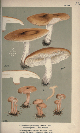
illustrations of british fungi (hymenomycetes), to serve as an atlas to the "handbook of british fungi"
psathyrella cotonea
illustrations of british fungi (hymenomycetes), to serve as an atlas to the "handbook of british fungi"
tricholoma ramentaceum
alexis-hubert jaillot
le neptune francois
map of maastricht by willem and johannes blaeu (1649)
grote gracht (maastricht)
7th portuguese india armada (almeida, 1505)
maps of cefala by braun & hogenberg
jonas daniël meijerplein 4, amsterdam
prints in the stadsarchief amsterdam
maps from university of amsterdam special collections
atlas der neederlanden
worm
eel
siege of lingen 1605
maps of lingen (ems)
gemeente atlas van nederland - north brabant
zeeland, north brabant
gemeente atlas van nederland - north brabant
oijen, north brabant
history of kloster weihenstephan
churbaierischer atlas - klöster
maps by christian sgrothen
garzweiler
prints by abraham rademaker in the stadsarchief amsterdam
sloterweg, amsterdam
gemeente atlas van nederland - groningen
maps of bellingwolde
gemeente atlas van nederland - north brabant
maps of eersel
gemeente atlas van nederland - groningen
maps of ezinge
gemeente atlas van nederland - north brabant
maps of waalre
gemeente atlas van nederland - north brabant
maps of terheijden
gemeente atlas van nederland - north brabant
maps of boxmeer
gemeente atlas van nederland - north brabant
maps of woensdrecht
gemeente atlas van nederland - groningen
maps of grootegast
gemeente atlas van nederland - groningen
maps of kantens
gemeente atlas van nederland - groningen
maps of muntendam
gemeente atlas van nederland - north brabant
maps of waalwijk
gemeente atlas van nederland - groningen
maps of uithuizermeeden
gemeente atlas van nederland - groningen
maps of middelstum
gemeente atlas van nederland - groningen
maps of baflo
gemeente atlas van nederland - north brabant
maps of cromvoirt
gemeente atlas van nederland - north brabant
maps of oisterwijk
gemeente atlas van nederland - utrecht
maps of lopik
gemeente atlas van nederland - north brabant
maps of boxtel
gemeente atlas van nederland - groningen
maps of adorp
gemeente atlas van nederland - limburg
maps of nederweert
gemeente atlas van nederland - overijssel
maps of bathmen
gemeente atlas van nederland - north brabant
maps of klundert
gemeente atlas van nederland - groningen
maps of ulrum
atlas beudeker
sluis in art
maps from university of amsterdam special collections
atlas der neederlanden
worm
eel
worm
eel
worm
eel
worm
eel
worm
eel
worm
eel
maps of territories in the burgundian circle
17th-century maps of the north sea
historical
history
historical
history
prints by stefano della bella in the metropolitan museum of art
baroque
old maps of limburg, netherlands
1884 in limburg (netherlands)
illustrations of british fungi (hymenomycetes), to serve as an atlas to the "handbook of british fungi"
lepista amara
prints in the stadsarchief amsterdam
albert jan verbeek (physician)
13401 - 13500 of 38,380
Next page
/ 384